Followers

Showing posts with label climate. Show all posts

Tuesday, July 12, 2016

The Wet Sahara


Alice C. Linsley

There once was a seabed flowing through the Sahara. Fossils indicate that the sea supported the largest sea snakes and catfish that ever lived. This was the home of the Proto-Saharan populations, peoples who shared many common beliefs, customs and symbols. Their civilization was at its peak between 10,000 and 4000 BC when the Sahara was wet

During the period called the African Aqualithic, the major water systems connected the Nile and Central Africa. The historian Roland Oliver describes the Green Sahara as follows:
"[In] the highlands of the central Sahara beyond the Libyan desert,... in the great massifs of the Tibesti and the Hoggar, the mountaintops, today bare rock, were covered at this period with forests of oak and walnut, lime, alder and elm. The lower slopes, together with those of the supporting bastions — the Tassili and the Acacus to the north, Ennedi and Air to the south — carried olive, juniper and Aleppo pine. In the valleys, perennially flowing rivers teemed with fish and were bordered by seed-bearing grasslands."

The 8000 year black mahogany Dufuna dugout was found in the Sahara buried 16 feet under clays and sands whose alternating sequence showed evidence of deposition in standing and flowing water. Peter Breunig (University of Frankfurt) wrote this description of the Dufuna boat:
“The bow and stern are both carefully worked to points, giving the boat a notably more elegant form”, compared to “the dugout made of conifer wood from Pesse in the Netherlands, whose blunt ends and thick sides seem crude”. Judging by stylistic sophistication, Breunig reasons that, “It is highly probable that the Dufuna boat does not represent the beginning of a tradition, but had already undergone a long development, and that the origins of water transport in Africa lie even further back in time.”

African Sheer Zone
Gray areas are interconnected water systems


In ancient times, there was commerce along the interconnected river systems that extended from the Nile to the Atlantic Ocean. Rock paintings in the Sahara show people moving cattle on boats. The boat types include sickle, incurved sickle, square, incurved square and flared, as found on the prehistoric rock art of the Central Eastern Desert of Egypt.


The data of Genesis indicates Africa as the point of origin of Abraham's Horite Hebrew ancestors. The shrine city of Nekhen on the Nile dates to 3800 BC and was an early site of Horite Hebrew worship. It has a twin city on the opposite side of the river.

The Sumerians were dispersed cattle-herding Proto-Saharans. This explains the cultural and linguistic similarities between ancient roots in African languages and Sumerian and Akkadian. Akkadian was the language of Nimrod's territory in Mesopotamia. Nimrod was a Kushite kingdom builder (Gen. 10:8).

The aquatic civilization of middle Africa has increasingly gained the interest of archaeologists, anthropologists and linguists. They have found archaic burial grounds (7500 BC), a royal city in the jungle of Nigeria with 72 foot high ramparts that run for a 100 miles, prehistoric rock shelters and petroglyphs. Also 9000 year fish bones, harpoons, and pottery along dried river and lake beds.

Alex Wilshaw describes the changes that took place in middle Africa and along the Mega-Nile Valley.
The Late-Pleistocene/Holocene period was characterised by wet and dry phases (pluvials and interpluvials) that caused a series of associated changes in lake levels; these changes ranged from full lake overflow (when the lakes of Nakuru and Elmenteita formed a single body of water) to complete desiccation, which resulted in an archaeological hiatus between 6.0 and 4.0 thousand years ago (kya). Within the lake basins, there are three different types of ecologies that exist in bands at different altitudinal levels – savannah (lowland), bush-woodland (mid-range) and montane-forest (highland). The climatic changes caused these ecological bands to migrate altitudinally; wet phases led to the expansion of bush and montane-forest into lowland areas, and arid phases saw the expansion of savannah lands to higher altitudes. (From here.)


Related reading: The Historicity of Noah's FloodWater Systems Connected Nile and Central Africa; When the Sahara Was Wet; Sudan is Archaeologically Rich; 70,000 Year Settlement in the SudanThe Lithic Traditions of Late Pleistocene settlement at Afad, Sudan by Piotr Osypiński; Boats and Cows of the Proto-Saharans; Cemetery Dates to Time Before Noah; African Stone, Shell and Egg Technologies; Why Nekhen is Anthropologically Significant


Friday, April 29, 2016

As in the days of Noah


The Apostles asked Jesus, "When shall these things be?" They were asking about the dawning of the Kingdom of God. In reply, Jesus said:
"But of that day and hour no one knows, not even the angels of heaven, nor the Son, but the Father alone. For the coming of the Son of Man will be just like the days of Noah. For as in those days before the flood they were eating and drinking, marrying and giving in marriage, until the day that Noah entered the ark… Then two men will be in the field; one is taken and one is left. Two women will be grinding at the mill; one is taken and one is left. Watch therefore, for you do not know on what day your Lord is coming." (Matthew 24:36-42)
In this passage from Matthew's Gospel Jesus compares the coming Day of Judgement to events surrounding Noah's survival of the flood. In that great flood some died and some were spared.  Those who were spared owed their salvation to God's intervention in their lives.  Noah, a great ruler in the region of Lake Chad, was a righteous man who listened to God and obeyed.  Likewise, on that great Day, some will experience salvation through faith while others will be lost. This passage is about the Judgement. To make it be about the "Rapture" is to do damage to the text.

The term "rapture" is taken from St. Jerome's Latin translation of 1 Thessalonians 4:17—"we will be caught up" [Latin: rapiemur]. The Rapture is a cherished doctrine of American Fundamentalists. It has been perpetuated through popular books and movies. The doctrine maintains that Christ will return twice, first to the sky where He will gather to Himself all the elect, and later to the Earth for the Day of Judgment. A deep study of the Bible does NOT support this view.

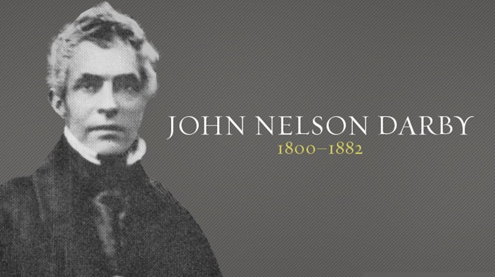
The rapture was popularized in the 1970s by Hal Lindsey’s novels, especially The Late Great Planet Earth, and more recently by the apocalyptic fiction of Tim LaHaye and Jerry B. Jenkins. These writers were elaborating on an idea that appeared in the thought of John Nelson Darby, considered to be the founder of Dispensationalism. Belief in "the Rapture" is a key element of Dispensationalism.


John Nelson Darby


For Americans, the most influential figure of Dispensationalism was C.I. Scofield who perpetuated this doctrine in the footnotes of his Scofield Reference Bible. Many who uncritically read the Scofield Bible have adopted the doctrine, though it has no precedent in the Church or in the writings of the Church Fathers.

According to Dispensationalists, when Christ returns, those who have died in Christ will be raised to a glorious state, along with all living believers. As a body these will be caught up from the Earth to be with Jesus Christ. This is the assumption based on 1 Thessalonians 4:16–17, which states, "For the Lord himself will descend from heaven with a cry of command, with the archangel’s call, and with the sound of the trumpet of God. And the dead in Christ will rise first; then we who are alive, who are left, shall be caught up together with them in the clouds to meet the Lord in the air; and so we shall always be with the Lord."

Here the Apostle Paul is stressing the bodily resurrection and proper order. He is describing the Last Day, not an intermediate event when the faithful are "caught up" as was the mysterious Enoch of old.

In the Bible, God reveals enough about the future to give us hope, but not so much that we can trust in ourselves for salvation. Noah was a faithful ruler who recognized the Creator as his God and obeyed Him as his Lord. He lived in a time much like our own, with the effects of climate change and a dependence on false spirituality.

Before His ascension, the Apostles asked Jesus, "Lord, is it at this time You are restoring the kingdom to Israel?" Jesus said to them: "It is not for you to know the times or dates the Father has set by his own authority." (Acts 1:7)

Because no one knows the day and hour when the second advent will occur, many assume that it is impossible to say anything more precise in regard to Christ's return than what is stated at Matthew 24 and Acts 1:7. However, we should ask this question: "What were the days of Noah like?" Today there is a great deal of information about Noah's homeland at the time of the flood. We also have a good picture of the customs of the people around him that displeased the Creator.

Many who lived in the region of Noah's homeland relied on shamanic ritual to gain favor from the spirits. The ruler-priests of Noah's line did not perform these rituals. Instead they offered burnt sacrifice to atone for the sins of their people and they did not consult spirits. Their worldview was distinct from the worldview of the prehistoric pagans, just as today the worldview of Christian priests is distinct from the worldview of shamans and modern pagans who rely on rituals rather than the atoning work of the Incarnate Christ.

It is sufficient for us to know that God has appointed a day for the restoring of all things. It is sufficient for us who await that day to continue in the Apostles' teaching, in the breaking of bread, and in prayer.

As with Noah, we are to be vigilant, ever watchful, heeding the Creator's warnings so that we are ready for the Last Day. It took many years for the waters to accumulate in Noah's homeland to the point where the great water systems overflowed into one another. So there is time, though limited, for people to be warned of the Judgement that is to come.

The Church Father Origen has this to say about the vigilance that is to characterize the Christian life:
All who listen to the depths of the gospel and live it so completely that none of it remains veiled from them care very little about whether the end of the world will come suddenly and all at once or gradually and little by little. Instead, they bear in mind only that each individual’s end or death will arrive on a day and hour unknown to him and that upon each one of us “the day of the Lord will come like a thief.” It is important therefore to be vigilant... When God the Word comes and brings an end to the progress of this life, he will gather up the one who gave “no sleep to his eyes nor slumber to his eyelids” and kept the commandment of the One who said, “Be vigilant at all times.”…But I know another kind of end for the righteous person who is able to say along with the apostle, “Far be it from me to glory except in the cross of our Lord Jesus Christ, through whom the world is crucified to me and I to the world.” In a certain sense, the end of the world has already come for the person to whom the world is crucified. And to one who is dead to worldly things the day of the Lord has already arrived, for the Son of man comes to the soul of the one who no longer lives for sin or for the world. (Commentary on Matthew 56)
Related reading: Noah's Ark; Dispensationalism and the Three Witnesses; The Kingdom of God in Genesis; Male Spiritual Leaders: Two Patterns; Shamanic Practice and the Priesthood; Was Noah Mesopotamian or Proto-Saharan?; Ken Ham and the "Ark Park" Miss the Boat


Saturday, July 4, 2015

Climate Studies and the Book of Genesis


Alice C. Linsley


Plato recounts that "Many great deluges have taken place during the nine thousand years" since Athens and Atlantis were preeminent. In these floods, water rose from below, and only those who lived on the mountains survived. He reports that the third great flood before Deucalion washed away most of Athens' fertile soil. [Timaeus 22; Critias 111-112]

The ancient Egyptians believed that flooding represented divine punishment of rebellion against Ra/Atum's appointed ruler. "People have become rebellious [lawless]. Atum said he will destroy all he made and return the earth to the Primordial Water which was its original state." (Genesis 1:2)


The African Humid Period

Noah was a Proto-Saharan ruler at a time when the Sahara was wet. According to Dr Kevin White, “Over the last 10,000 years, there have been two distinct humid phases, separated by an interval of highly variable but generally drying conditions between roughly 8,000 and 7,000 years ago. Another drying trend took place after about 5,000 years ago, leading to today’s parched environment.”

Noah lived during the time of wetness in the region of Lake Chad during the “Aqualithic" or African Humid Period (8000-4000 BC), also known as the Holocene Wet Period. This was before the rise of the first dynasty of Egypt. This places Noah and his sons in relatively recent history, not at the dawn of human existence.

The word Chad/Tchad is related to the Nilotic Luo word chaddhoreh, meaning a wound or a bruise. In Isaiah 1:6 the King James Version translates chabbarah as "bruises." The Luo word also refers to a depression where something has been cut out, plucked out, or bruised. A depression of this type is called chaddhoreh in Luo. The word "Chad" describes the basin which filled with water during the prolonged period of wetness.

About 7500 years ago Lake Chad was 130 feet deeper than it is today and covered an area of about 135,000 square miles (350,000 sq km). The footprint of ancient Mega-Chad has been confirmed by satellite photography. 

During the African Humid Period the Nile waters swelled from increased rainfall and cut a deeper and wider floodplain, extending well into Sudan to the west. There was then water access to the Giza Pyramids and both Nekhen and Nekheb (Elkab) were on the banks of that great north-flowing river.


Fortified oasis of Djado in Niger along the banks of a dry riverbed.
The ruins are about 1000 years old.


The Djado Plateau lies in the Sahara, in northeastern Niger. It is known for its cave art, but is now largely uninhabited, with abandoned towns and forts still standing. Ancient rivers cut deep canyons in the red rocky landscape. The many archaeological sites are a testament to the fact that the climate was once favorable to human habitation. There is evidence of widespread human settlements in the region over 50,000 years ago.

Ancient water systems connected the Nile and Central Africa. This is evident in the map below showing the African Sheer Zone.


Rifting, combined with prolonged rains, caused this entire region to flood. Lake Chad is located at the boundary of Niger, Nigeria, Chad, and Cameroon.


Mega-Nile

The eastern Sahara Desert was once home to a large lake in the White Nile Valley floor. This is likely the western boundary of Biblical Eden, a vast watery world that extended to the Tigris-Euphrates Valley and the Indus River Valley. According to this report, the mega lake was probably formed more than one hundred thousand years ago in the White Nile River Valley in Sudan.


Between 10 and 12 thousand years ago the Nile system filled with waters from the Angolan Highlands, the result of geological uplift which created Lake Victoria and directed its excess flow north in the White Nile. The White Nile provides most of the Nile's water during the dry season. During this period, there were water routes between the Nile and the Chadic and Niger water systems through a series of shallow lakes in the Sahara. This explains the common plant and animal species found in all three water systems.

As the Sahara dried out, human populations and their cattle found it necessary to move toward the major water systems of the Benue Trough, Lake Chad, and the Nile. The Sahara became increasingly depopulated. In the words of Leviticus 26:19, the heavens became like iron and the earth like brass.

The now dry Botswanan basin was once a sea filled with water from the Angolan Highlands. Some of Africa's earliest human populations lived on the edges of this great lake and evidenced by thousands of man-made stone tools found there. The tools include mace heads and date to between 80,000 and 100,000 years.


Arid Phase in the Southern Levant

A core drilled from the Sea of Galilee was subjected to high resolution pollen analysis for the Bronze and Iron Ages. The detailed pollen diagram (sample/~40 yrs) was used to reconstruct past climate changes and human impact on the vegetation of the Mediterranean zone of the southern Levant. The chronological framework is based on radiocarbon dating of short-lived terrestrial organic material. The results indicate that the driest event throughout the Bronze and Iron Ages occurred ~1250–1100 BC, at the end of the Late Bronze Age. This likely was one factor among many that contributed to the so-called "Iron Age Collapse". Read the full report here.

Wednesday, June 12, 2013

Reality Climate Ideologues Won't Face


Hundreds of millions of dollars that have gone into the expensive climate modelling enterprise has all but destroyed governmental funding of research into natural sources of climate change. For years the modelers have maintained that there is no such thing as natural climate change…yet they now, ironically, have to invoke natural climate forces to explain why surface warming has essentially stopped in the last 15 years! -- Roy W. Spencer, Ph. D.


Monday, May 27, 2013

Climate Change and Human Innovation


Changes in climate during the Stone Age forced our ancestors to develop new technologies, say scientists.

Bifacial points recovered from Blombos Cave, South Africa.

The research, published today in Nature Communications' looked at sediment cores drilled from the seafloor off the coast of South Africa. The tubes of rock gave the scientists an insight into the area's climate over the past 100,000 years.

They found periods of abrupt cooling occurred over very short time scales, with temperatures sometimes dropping as much as 15oC over a few decades. And, in contrast to the northern hemisphere and monsoon areas which got much drier, South Africa became much wetter.

'During these abrupt events, changes in ocean circulation meant there was less energy and warmth transported to the northern hemisphere and this allowed more heat to stay in the Southern hemisphere and pushed the warmth and rainfall further south, and that is what we then see in southeast Africa,' says Dr Martin Ziegler of Cardiff University who led the study. 'Where large parts of the globe got drier and ecosystems became less favourable, southeast Africa got warmer and wetter, providing conditions that were probably more hospitable for early humans.'

Once they had found this pattern of South Africa getting wetter during these cold events, the team went on to compare the timing against the archaeological record.

'When we compared our climate record to the archaeological record it was clear that periods of innovation in early humans always occurred during the warmer and wetter periods,' says Ziegler. 'Around 80-60,000 years ago we find certain industries in the archaeological record, like more sophisticated tools, the first evidence of symbols and the use of jewellery.'

Read it all here.


The now dry Botswanan lake basin was once a sea. It filled with water from the Angolan Highlands. Some of Africa's earliest human populations lived on the edges of this great lake, evidenced by thousands of stone tools found there. The tools include mace heads dating to between 80,000 and 100,000 years.


Friday, March 8, 2013

Kansas Bill Calling for Objectivity in Science Fails


Nobody is interested in solutions if they don't think there's a problem. Given that starting point, I believe it is appropriate to have an over-representation of factual presentations on how dangerous (global warming) is, as a predicate for opening up the audience to listen to what the solutions are.... --- Al Gore, chairman and co-founder of Generation Investment Management, a London-based business that sells carbon credits (Grist Magazine May 9, 2006)


Alice C. Linsley


The Kansas legislature had considered a House Bill 2306 calling for objectivity in science. The bill was introduced by the House Standing Committee on Education and is supported by medical doctors who also wish to see balance in science education. The bill states:

The legislature recognizes that the teaching of certain scientific topics, such as climate science, may be controversial. The legislature encourages the teaching of such scientific controversies to be made in an objective manner in which both the strengths and weaknesses of such scientific theory or hypothesis are covered.

The committee sponsoring the bill has been called "anti-science" and in denial about global warming. The response from this journalist is typical.

The clause that sticks in the journalist's throat is this: "such as climate science". He assumes that the popular theory of global warming is an accurate one and beyond further investigation. The Kansas Standing Committee on Education recognizes that objectivity is necessary for a sound science education. It is essential to the empirical method of science.

One thing is certain. Climate ideologues do not want to listen to real climate scientists such as Dr. Roy W. Spencer, who notes:

Hundreds of millions of dollars that have gone into the expensive climate modelling enterprise has all but destroyed governmental funding of research into natural sources of climate change. For years the modelers have maintained that there is no such thing as natural climate change…yet they now, ironically, have to invoke natural climate forces to explain why surface warming has essentially stopped in the last 15 years!

Another certainty is that Earth's atmosphere, seas, and climate conditions are dynamic. Antarctica was once home to a diverse range of tropical plants including ferns, palms, Baobab trees and rainforest trees.

1000 year old baobab tree in Africa

It is also certain that little progress has been made in reducing emissions. As the chart below shows, carbon dioxide emissions are at the same level today as they were in 1992.


Greenhouse gas emissions were higher in 2010 than in 1990, as shown in the chart below.


Alarmists and those profiting from the global warming “crisis” stress the melting of the Arctic glacial ice but conveniently fail to point out that the snow caps on South America highest mountains and the glacial mass in Antarctic are growing. Here is the report:

An International Polar Year aerogeophysical investigation of the high interior of East Antarctica reveals widespread freeze-on that drives significant mass redistribution at the bottom of the ice sheet. While surface accumulation of snow remains the primary mechanism for ice sheet growth, beneath Dome A 24% of the base by area is frozen-on ice. In some places, up to half the ice thickness has been added from below. These ice packages result from conductive cooling of water ponded near the Gamburtsev Subglacial Mountain ridges and supercooling of water forced up steep valley walls. Persistent freeze-on thickens the ice column, alters basal ice rheology and fabric and upwarps the overlying ice sheet, including the oldest atmospheric climate archive, and drives flow behavior not captured in present models. (Source: Science Magazine)

The rise and fall of ice ages is caused by changes in the Earth's orbit around the Sun due to the influence of the other planets. These changes are slight and can be triggered by events like the earthquake and tsunami recently experienced in Japan.

The earliest ice ages came about every 41,000. Later ones came every 100,000 years. Scientists do not know what caused the change from 40,000 to 100,000 years, but they have noticed that the 100,000 year cycle aligns with periods of Earth’s more-elliptical orbits. Earth's orbit around the sun changes shape every 100,000 years, becoming either more round or more elliptical. The shape of the orbit is known as its "eccentricity." The 41,000-year cycle of the tilt of Earth’s axis is related. The original research correlating climate, glaciation and orbit and was done by University of California (Santa Barbara) geologist Lorraine Lisiecki.

Lisiecki believes that climate change involves complicated interactions between different parts of the climate system and three orbital systems: 1) eccentricity of Earth’s orbit; 2) tilt of Earth’s axis; and 3) precession or change in the orientation of the rotation axis.

The chart shows factors that influence climate change, glaciation and hemispheric climate reversals.


Earth's elliptical orbit around the Sun and the degree of tilt of Earth's axis in its path around the Sun, are factors that must be considered when discussing climate change. In the cycle of Earth’s Great Year the line off the North Pole axis (extending toward Polaris) scribes a complete circle in the heavens about every 25,800 years. A complete cycle takes between 25,000 and 28,000 years, depending on the amount of Earth's wobble. One cycle is “Earth’s Great Year” (also called a "Platonic Year.") Climate and atmospheric changes appear to become more acute toward the end and beginning of a new year.

This is evident when considering the sea and air temperatures of the last decade.

The "bi-polar seesaw" also influences climate change. Here we have inter-hemispheric imbalance in heat storage. Surface ocean records from the South Atlantic Ocean (Barker et al., 2009) show a climate change pattern opposed to that in Greenland ice cores supporting the view that asynchronous heat storage is instrumental in off-setting Northern and Southern Hemisphere climate change roughly every 1000 years.

Solar radiation is another factor in climate change and ice melt. Summer solar radiation varies in the two hemispheres due to cycles in the Earth's tilt and the elliptical orbit. The factors affecting the relationship between changes in the Earth's tilt and orbit and climate changes are very complex and not fully understood. 

Just when climatologists think they have it figured out, they discover how little they understand. Here's an example concerning lower solar irradiance and higher atmospheric temperatures:

The thermal structure and composition of the atmosphere is determined fundamentally by the incoming solar irradiance. Radiation at ultraviolet wavelengths dissociates atmospheric molecules, initiating chains of chemical reactions—specifically those producing stratospheric ozone—and providing the major source of heating for the middle atmosphere, while radiation at visible and near-infrared wavelengths mainly reaches and warms the lower atmosphere and the Earth’s surface1. Thus the spectral composition of solar radiation is crucial in determining atmospheric structure, as well as surface temperature, and it follows that the response of the atmosphere to variations in solar irradiance depends on the spectrum2. Daily measurements of the solar spectrum between 0.2 µm and 2.4 µm, made by the Spectral Irradiance Monitor (SIM) instrument on the Solar Radiation and Climate Experiment (SORCE) satellite3 since April 2004, have revealed4 that over this declining phase of the solar cycle there was a four to six times larger decline in ultraviolet than would have been predicted on the basis of our previous understanding. This reduction was partially compensated in the total solar output by an increase in radiation at visible wavelengths. Here we show that these spectral changes appear to have led to a significant decline from 2004 to 2007 in stratospheric ozone below an altitude of 45 km, with an increase above this altitude. Our results, simulated with a radiative-photochemical model, are consistent with contemporaneous measurements of ozone from the Aura-MLS satellite, although the short time period makes precise attribution to solar effects difficult. We also show, using the SIM data, that solar radiative forcing of surface climate is out of phase with solar activity. Currently there is insufficient observational evidence to validate the spectral variations observed by SIM, or to fully characterize other solar cycles, but our findings raise the possibility that the effects of solar variability on temperature throughout the atmosphere may be contrary to current expectations.(Nature 467, 696-699 (7 October 2010) Published here on 6 Oct. 2010)

These words bear repeating: "Currently there is insufficient observational evidence to validate the spectral variations observed by SIM, or to fully characterize other solar cycles..." 

There are good reasons to push for objectivity in climate science. It is complex and scientists do not agree on all the factors and mechanisms affecting climate. Climate science, as with all science, requires objectivity. Kansas schools are not unique in the problem of science fads and dogmas posing as science.

"Schools are generally not teaching climate science, but the dogma that human-caused emissions of carbon dioxide are causing catastrophic climate disruption," states Jane Orient, M.D., president of Physicians for Civil Defense. "This alarmism resembles religious dogma."

House Bill 2306 says teachers will “provide information to students of scientific evidence which both supports and counters a scientific theory or hypothesis” and encourages the “teaching of such scientific controversies to be made in an objective manner.”


Wednesday, September 5, 2012

Noah's Homeland in Historical Perspective


A ship made of gopher (Gen. 6:14). Noah's ark would have looked like this.


Alice C. Linsley


There is a time honored tradition that associates Noah with the region of Lake Chad. Here we find the territory of Bor-No which means "Land of Noah." It is sometimes spelled Bor-Nu which means "Land of Gold" because Proto-Saharan kings such a Noah had access to the mineral resources of the Upper Nile.

The Sahara known to Noah was a wet place. According to Dr Kevin White, “Over the last 10,000 years, there have been two distinct humid phases, separated by an interval of highly variable but generally drying conditions between roughly 8,000 and 7,000 years ago. Another drying trend took place after about 5,000 years ago, leading to today’s parched environment.”

When Noah lived, approximately 2490-2415 BC, the Sahara experienced a wet period (Karl W. Butzer 1966). This is the period of the Old Kingdom, a time of great cultural and technological achievement. This places Noah and his sons in relatively recent history, not at the dawn of human existence.

The oldest known zoological collection was found in this region during excavations at Nekhen (Hierakonpolis) in 2009. The royal menagerie dates to ca. 3500 BC and included hippos, hartebeest, elephants, baboons and wildcats. Proto-Saharan rulers, like Noah, kept personal menagerie and in a time of flood would have made provision for the animals.

Nekhen is the oldest known site of Horite Hebrew worship. It was a shrine city as early as 4000 BC.

At least 3,500 years before Noah people were using dugouts to navigate the rivers of the Sahara. This is attested by the discovery of an 8000 year old black mahogany dugout in Dufuna in the Upper Yobe valley along the Komadugu Guna River in Northern Nigeria.

The 8000-year Dufuna boat was found in Nigeria.

Sir Harry Johnston
(1858-1927), an agent of British colonial system in West Africa, wrote several books on the history and linguistics of Africa. He makes the earliest reference to Bornu as a version of Borno and connects this region to biblical Noah.

In his 1836 monograph Anacalypsis: An Inquiry into the Origins of Languages, Nations and Religions, Godfrey Higgins noted that the reference to Noah's ark landing in the mountains of Ararat in "Armenia" could mean simply that it landed on "mount of Meru… that is, Ar or Er-Meni-ia, the country of mount Meru or Meni."

Higgins noted the linguistic similarity between Meru and Meni. Meru is spelled Meri in Egyptian and Meri is sometimes spelled Meni, with the n taking the place of the r, in Southeastern Asian languages like Siamese, where the Virgin Mary is called Mania.

Noah's mountain became Meru, the sacred mountain of  Hinduism and Buddhism. According to Buddhist tradition, the island of Sri Lanka broke off from Meru. Many Hindu temples have been built as symbolic representations of Mount Meru with its seven seas and seven surrounding mountain walls.

In the Bhagvad Gita, Lord Krishna says, "Among the mountains, I am Meru", that is the spinal cord of the world. The Vishnu Purana (c. 200 BC) details how there are seven continents ringed by seven oceans. This cosmology was a mirror image of the seven planets/bowls above. Here we have an example of the celestial archetypes about which Mircea Eliade writes in the Myth of the Eternal Return.

The Hindu story may contain a kernel of history. Noah may have settled on Mount Meru, Africa’s fifth highest mountain, located in northern Tanzania. It stands at 15,000 feet and is 42 miles west-southwest of Mount Kilimanjaro, near the Kenyan border. 

The Nigerian philologist Modupe Oduyoye observed the Noah-Borno connection in his book The Sons of Gods and the Daughters of Men (1984, Orbis Books). Oduyoye has written here about the African background of Genesis.


Proto-Saharan Climate

New evidence from satellite images reveals that the Nile flooded more extensively than previously thought. The waters spread nearly 100 miles west of the river and created "mega-lakes" in what is today the Sahara desert. (Read more here.)

The Chadic Sea in turn connected to the Benue and Niger River Troughs so that travel and commerce was possible on the major water systems from the Atlantic coast of modern Nigeria to the Nile, the Red Sea, The Arabian Ocean and Indian Ocean. At the time of Noah and his ancestors Cain and Seth, the Sahara was Green. 

This is how the historian Roland Oliver has described the Green Sahara: "[In] the highlands of the central Sahara beyond the Libyan desert,... in the great massifs of the Tibesti and the Hoggar, the mountaintops, today bare rock, were covered at this period with forests of oak and walnut, lime, alder and elm. The lower slopes, together with those of the supporting bastions — the Tassili and the Acacus to the north, Ennedi and Air to the south — carried olive, juniper and Aleppo pine. In the valleys, perennially flowing rivers teemed with fish and were bordered by seed-bearing grasslands."

In Noah's time boating and fishing industries were active on Lake Chad. The average fishermen used canoe dugouts which they could carve themselves, but nobles, such as Noah, used boats constructed of marsh reeds lashed together and sealed with pitch. It is likely that Noah had a fleet of such boats.

Proto-Saharan rulers were known to keep ménageries. The animals were kept in pairs so that they would reproduce. Likely these were the animals that Noah preserved by moving them on boats.

Lake Chad was at least 130 feet deeper than it is today and covered an area of about 135,000 square miles (350,000 sq km). The footprint of ancient Mega-Chad has been confirmed by satellite photography. The Nile waters swelled from increased rainfall and cut a deeper and wider flood plain, extending well into Sudan to the west. The area attracted merchants from southern Africa who moved their cargo along the rivers and paid tariffs to the chiefs who controlled the river junctions.


Evidence of the Holocene Wet Period

The Holocene Wet Period has be called the "Gurian Wet Period" and the "African Aqualithic."  The latter term was coined by British archaeologist John Sutton (Journal of Africa History 1974; Antiquity 1977).

Between 10 and 12 thousand years ago the Nile river system filled with waters from the Angolan Highlands, the result of geological uplift which created Lake Victoria and directed its excess flow north in the White Nile. The White Nile provides most of the Nile's water during the dry season.

The Holocene Wet Period owes the abundance of water to climate cycles related to Earth's Great Year, to monsoons off the Indian Ocean, and to the African rifts that created great watersheds or troughs.

Rifting combined with prolonged rains caused this entire region to flood.
Lake Chad is located at the boundary of Niger, Nigeria, Chad and Cameroon. 

Between 12 and 10 thousand years ago, the Nile connected to the Chadic and Niger water systems through a series of shallow lakes in the Sahara Desert. This explains the common plant and animal species found in all three water systems.

The now dry Botswanan lake basin was once a sea filled with water from the Angolan Highlands. Some of Africa's earliest human populations lived on the edges of this great lake and evidenced by thousands of man-made stone tools found there. The tools include mace heads and date to between 80,000 and 100,000 years.


Ancient Accounts of a Wet Period

Plato recounts that "Many great deluges have taken place during the nine thousand years" since Athens and Atlantis were preeminent. In these floods, water rose from below, and only those who lived on the mountains survived. He reports that the third great flood before Deucalion washed away most of Athens' fertile soil. [Timaeus 22; Critias 111-112]

The ancient Egyptians believed that flooding represented divine punishment of rebellion against Ra/Atum's appointed ruler. "People have become rebellious [lawless]. Atum said he will destroy all he made and return the earth to the Primordial Water which was its original state." (Genesis 1:2)

The chaotic waters is called tehom (Hebrew: תְּהוֹם‎) in Genesis 1 and has a Nilotic origin. It refers to is an ancient concept of a disordered deep God put in order by His Word (Egyptian hu or hut). Tehom is subdued by Tehut. The oldest known moral code is the Law of Tehut which dates to about 5,000 BC.

In Genesis 6:9-11, we are told that Noah was God's favored ruler on earth; "an upright man among his contemporaries." God saw that the earth was corrupt and full of lawlessness and determined to destroy the lawless ones by a great flood.

Genesis 2:10-14 says that Abraham's ancestors lived in a vast wet region which the Bible calls "Eden." It was watered by the Tigris, the Euphrates, the Pishon and the Gihon. The first two are in Mesopotamia and the last two are in Africa. This is the heart of the Afro-Asiatic Dominion which extended from Niger to Pakistan, India, Nepal and Cambodia. This is the place of origin of Abraham's ruler-priest ancestors and of "him that holds the scepter from the house of Eden." (Amos 1:5)

Genesis 2:11 states that the Pishon "flows through the whole land of Havilah." Ha-vilah refers to the head waters or place where the waters originate. It is also the territory of Havilah, a son of Kush (Gen. 10:7). The Kushites lived in the upper Nile region and the Sudan. Kushite kings were the early rulers of Egypt. The Upper and Lower Nile regions were first united by the Kushite warrior-king Menes.

Noah was the great grandfather of Kush. Kush's first born sons by his two wives were Nimrod (Gen. 10:8) and Raamah (Gen. 10:6). They ruled over separate territories in the ancient Afro-Asiatic Dominion. Nimrod ruled in the Tigris River valley. Raamah and his son Dedan controlled the eastern coastal area of the Yam Suph (Red Sea).

DNA studies have confirmed the Kushite migration out of Africa. However, there were already human populations scattered across the earth, especially at the more temporate zones. Some of those populations resulted from earlier migrations out of Africa. The first took place about 120,000 years ago and the second about 70,000 years ago. The Kushite expansion coincided with the spread of the Horite Hebrew religion. In Akkadian texts these priests were called "Abru" which is "Hebrew" in English Bibles.
 
The climate change that brought gradually drier conditions to what was once a vast wet world is explained in various sacred texts. The dry land swallowed the excess waters. The Koran [11:25-48] refers the earth swallowed the water, and says that Noah's boat came to rest on the mountain Al-Judi." 

In Revelation 12 the devil-dragon spews a flood of water to destroy the sun-clothed Woman who bore the Divine Son, but the earth protected the Woman and Child by swallowing the flood. This recapitulates the Genesis 3:15 reference to Woman giving birth to the Divine Seed.


The Extent of the Flooding During Noah's Time

Paul Sereno unearthed 10,000 year old skeletons at Gobero in Niger. These were buried on the edge of a paleolake on the northwestern rim of the Chad Basin. The Gobero site is the earliest known cemetery in the Sahara and the skeletons found there indicated that some were at least 6 feet tall.


Gobero skeleton (G3B8) measures 6 feet 6 inches
Photo (c) Mike Hettwer, courtesy Project Exploration

According to Sereno, these earlier Holocene people left when it became arid, but the area was repopulated by a taller people around 4600 B.C. when humid conditions returned. Flooding occurred on and off over a long period. Wet conditions prevailed from 7700-6200 (phase 2). Sereno states, "The darkened bone color of all human skeletons in phase 2 burials is indicative of sustained inundation." (Read about Sereno's findings here.)

Another wet period corresponds to the time that Noah would have lived in the region of Lake Chad, between 3000 and 2500 B.C.

At the time of the Gobero populations (9700-4400 years ago), humans were dispersed globally, and during the time of Noah these populations were not destroyed. Consider the following population estimates by urban center between 3000 and 2200 BC, around the time when Noah's flood would have occurred:

Memphis, Egypt - 32,000 inhabitants
Lagash, Iraq - 60,000 inhabitants
Mohenjo-daro, Pakistan - 40,000 inhabitants
Mari, Syria -50,000 inhabitants

Baodun settlements, China - Baodun is the largest settlement, covering an area of about 373 miles. There is no evidence of destruction by flooding though all six Baodun settlements straddled the Min River in central Sichuan province. The Min is a tributary of the upper Yangtze River.

There is no evidence that any of these peoples were wiped out by a worldwide flood. The evidence simply does not support the interpretation that all the peoples of the earth were destroyed in a catastrophic global flood and that the earth was repopulated by Noah's descendants.

Wednesday, May 2, 2012

Potts' Variability Hypothesis Has Biblical Support

Alice C. Linsley


Paleoanthropologist Rick Potts is the director of the Smithsonian’s Human Origins Program and curator of anthropology at the National Museum of Natural History. His research pieces together a record of Earth’s environmental change and human adaptation to environmental instability.

In this NOVA interview Dr. Pott's explains his "climate variability hypothesis" which he sees as a significant factor in human adaptability, settlement and migration. His idea has Biblical support.


Dr. Rick Potts
Dr. Potts said:

Climate change had always been on people's minds when it came to human evolution. The idea that was around for a long time is that the establishment of a savanna environment, the grassy environment with a few trees, was critical to human evolution early on, and that and the Ice Age later on presented the challenging environment in which humans evolved.

But when I began the work here at Olorgesailie, we kept seeing layer after layer of environmental change, from soils to volcanic ashes to a lake to a drought when the lake completely evaporated. We saw this through 700,000 years, and I began to think, well, maybe it's not the particular environment of a savanna that was important, but the tendency of the environment to change, to vary in very dramatic ways. And we saw that the large grazing animals of the savanna—elephants, baboons, pigs, zebras, all of whom ate grass—disappeared in the time period when worldwide climate began to vary the most.

So it dawned on me: Rick, you're an anthropologist. Maybe this has something to do with human evolution, and it's not the survival of the fittest in any one environment but the survival of the more versatile, the more general and flexible creatures that would really persist over time. This gave me a new insight into human evolution. The origin of stone tools, the expansion of the brain, and the complexity of social life that we see with the emergence of our own species may actually be a response not to just the dry savanna or the cold Ice Age but to the wide and dramatic variability of climate over time.

In some cases the landscape change occurred within a few thousand years. But this is all within a larger cycle of changing—Earth's orbit around the sun, and changes from wet to dry in tropical Africa, and, later in time, changes that were on [a scale of] 100,000 years between ice ages and interglacial warmth.

Olorgesailie inspired our idea that climate variability was an important driving force in human evolution. But we had to look outside of Olorgesailie to many other early human sites to really test the idea. What we have found is that the most prolonged periods of climate variability early on corresponded with the origin of stone tools and of eating meat, and the origin of our own genus, Homo. Then, later on, another prolonged period of climate variability, very dramatic, corresponded with the origin of modern human behavior and our own species.

(Read more here.)

The key points of Pott's hypothesis are evident.  Life on Earth is sustained by water. Climate has an impact of the availability of water. Factors that influence water accumulation in lakes and rivers are Earth's climate cycles and plate tectonics. When water sources disappear, humans and aminals must seek other sources. Where abundant water sources exist, there is greater evidence of human habitation.


Life Depends on Water

A close reading of Genesis reveals that climate is certainly a factor in archaic human settlement and migration. Humans settled near major bodies of water. This is where they hunted large game and buthered them with stone hand tools.  During rainy periods, lakes swelled and during dry periods, lakes disappeared.  Climate cycles caused old dry basins to fill with water. This swelling and shrinking of water systems is evident from satellite photos taken of Earth's great rivers and lakes.

Neolithic peoples in the Sahara enjoyed abundant water.  The Nile connected to the Chadic and Niger water systems through a series of shallow lakes in the Sahara. This explains the common plant and animal species is found in all three river valleys. The now dry Botswanan lake was once a sea. Some of Africa's earliest human populations lived on the edges of this great lake, as evidenced by the thousands of stone tools found there. These include maceheads that date between 80,000 and 100,000 years.

Between 12,000 and 8,000 years ago all of the region between Lake Chad and the Nile was wet. The climate had changed, ushering in years of persistent, heavy rains. A briefer period of rain lasted between 3000 and 1900 B.C. This is the the time of Noah's flood. Noah was a Proto-Saharan ruler in region of Lake Chad. People living in this area, called "Bor-No" (Land of Noah), claim that this is Noah's homeland.

Lake Chad has been shrinking for centuries, but today rains are returning to the Sahara. West Africa is receiving abundant convective rainfall. At the close of "Earth's Great Year" in the summer of 1998, air and water temperatures peaked and this has affected rainfall in some of Earth's most arid regions.

Tropical temperatures (latitude 20N - 20S)

In 2010, Pakistan saw catastrophic flooding from the Indus River. These NASA photos show the striking contrast within a single year.

NASA image captured in 2009


NASA image captured in 2010


Geologic Factors

Tectonics also played a role. Rifting and continental extension creates water systems and inland seaways such as the Humer Seaway in North America.

About 150,000 years ago there was a major uplift of the Angolan ridge in equatorial Africa. This meant a permanent supply of water flowing to the Upper Nile and prompted migration to that area. Lakes formed in the basins, large enough to support fish, crocodile and hippopotamus. Early hunters camped along the lakes, as evidenced by heaps of domestic refuse at many sites along ancient lakes in Niger, Chad and Kenya.

Lake Chad filled and merged with the Mega-Chad Sea, creating a body of water comparable in size of modern Sudan. The overflow spilled southwest into the Benue Trough and flowed to the Atlantic. The Nile was transformed from a slow stream into a roaring river with mile-deep gorges. This was the beginning of the wet period that would turn the Sahara into vast grasslands able to support elephants, antelopes, gazelles, ostriches, giraffes, and hyenas.


River Civilizations Emerged

This extended wet period led to the establishment of a Nilotic civilization which appears to have climaxed in dynastic Egypt and in the Kushite expansion into Mesopotamia (Gen. 10:8-12). The Kushite expansion lead to the river-based Sumerian and Akkadian civilizations. These civilizations were dependent upon river commerce and the rulers controlled and taxed that commerce.

To understand the Kushite expansion we must consider a factor beyond climate and river commerce, namely, the custom of sent-away royal sons, a feature of human adaptation that Potts has not considered. The marriage and ascendancy pattern of the Proto-Saharan and Nilotic rulers drove expansion and migration out of Africa through the custom of sending away firstborn sons who were expected to establish territories for themselves.


Sent-Away Sons


Genesis 2:24 speaks of how a man is to move away after marriage. This refers to sent-away sons of the ruling lines among Abraham's ancestors. “For this reason a man will leave his father and mother, and shall cleave unto his wife and they shall become one flesh.” The married son was expected to leave his parents and to establish a new household.  Most Westerners tend not to respect grown men who stay home, whether married or not. Stay-at-home sons often compete with their fathers or become "momma's boys." Jacob's stay-at-home son was Reuben and Reuben slept with his father's concubine, Bilhah (Gen. 35:22; 49:4). David's son Absalom did the same thing. Absalom ordered that a tent be set up on the palace roof where everyone could see it (ii Sam. 16:2). There Absalom went in and had sex with his father's concubines. This action represented an attempt to usurp the ruler's authority.

An anthropologist reading Genesis 2:24 finds evidence of the establishment of a new household geographically separate from the husband’s family. This is called “neolocal residence.”  However, analysis of the marriage and ascendancy pattern of Abraham’s Horite people indicates that the neolocal pattern does not apply to the firstborn sons of the patriarch’s wives. It applies only to sent-away sons who did not ascend to the thrones of their fathers or maternal grandfathers.  Most sons of concubines also were sent away and often served as vassals of the firstborn sons of wives.

Another feature of the Horite ruler-priest marriage and ascendency structure is alluded to in Genesis 2:24 which speaks of “cleaving to the wife.”  This indicates matrilocal residence, an arrangement where the newly married couple lives with or in close proximity to the bride’s family. This pertains to the firstborn son of the patriarch’s second (cousin or niece) wife. This son was the heir to his maternal grandfather, after whom he was named, and he lived with or near his mother’s people. So Abraham's firstborn son by his second wife belonged to the household of Joktan, Keturah's father, after whom he was named.

Patrilocal residence pertained only to firstborn sons of the half-sister wife. This seems strange given the insistence of Bible scholars that ancient Hebrew society was patriarchal. This is why Isaac remained in Abraham's territory and why Abraham gave gifts to his other sons and sent them away from Isaac (Gen. 25:6).

Genesis 2:24 pertains to sons who lived away from their biological fathers. This includes “sent-away sons” and the firstborn son of the patriarch’s second wife. Jacob's case is especially interesting. He was not Isaac's firstborn son and though he attempted to rob that birthright from Esau, Jacob established his residence with his mother's people. This suggests that Jacob and Esau may not have been twins. They may have been Isaac's firstborn sons by different wives. Esau was the firstborn of Isaac's first wife who would have been Isaac's half-sister. Jacob would have been the firstborn son of Isaac's second wife. As the second wife was either a cousin or niece, as was Rebecca to Isaac, Jacob would have been Rebecca's firstborn son. As such he would belong to the household of his maternal grandfather, Bethuel. However, this doesn't mean that Jacob was heir to Bethuel's throne in Padan-Aram. Bethuel's heir appears to have been Laban.

Sent-away sons is a prominent theme in Genesis. Some see the story of Adam's expulsion from the garden as the first example.  However, Adam's historicity cannot be proven.  among verifiably historical figures we see this pattern with Cain who was banished for killing his brother. we find it at the end of Genesis in the account of Joseph who was sold into Egyptian captivity by his brothers.

The pattern continues in Exodus where Moses is forced to leave Egypt after killing a fellow Egyptian.  He travels to his Midianite kin and marries a patrilineal cousin, Zipporah. This suggests that Isha, Amram's cousin wife, was a Midianite bride. The Midianites were descendants of Abraham by his cousin wife Keturah.

Other sent-away sons include Ishmael and Yishbak, both sons of Abraham. The name Yishbak means “sent away.”


Related reading: Genesis and Climate Change; Climate Cycles Indicate a Dynamic Earth; Climate and Noah's Flood; When the Sahara Was Wet; Water Systems Connected Nile and Central Africa;
Sub-Saharan DNA of Modern Jews; Abraham's Sons


Wednesday, March 21, 2012

Answers to High Schoolers' Questions about the Flood


Alice C. Linsley


Part 4: The Flood
This continues the series on Questions that High Schoolers Ask about Genesis. Additional important data is provided here.


Q:  Was the flood global or regional?

A:  This was the question most often asked by the high school students about Noah's flood.  To answer this question we must consider who Noah was, where he lived, and the climate conditions that he experienced.  Not all of this information can be found in the Bible.  However, Genesis provides many clues that can direct the search for the historical Noah.

Noah lived approximately 2490-2415 BC, when the Sahara experienced a wet period (Karl W. Butzer 1966). This is the period of the Old Kingdom, a time of great cultural and technological achievement in Egypt.

Noah, a descendant of the men named in the Genesis 4 and 5 King Lists, was a great ruler.  The  rulers named in Genesis controlled the major water systems of Lake Chad, the Nile, and the Tigris and Euphrates.  The interconnected waterways were their roads. In other words, Noah would have been familiar with boats and likely had a fleet. 

These ancient rulers imposed taxes on cargo that moved through their territories. They used the rivers to expand their kingdoms and to spread their Afro-Asiatic worldview.  Nimrod is an example.  His father was Kush, a ruler who controlled a vast region of the Upper Nile.  Nimrod left the Nile region and built his kingdom along the Tigris in Mesopotamia. (Gen. 10:8-12)

Noah likely lived in the region of Bor-Nu (Land of Noah) near Lake Chad. This is the only place on Earth that claims to be Noah's homeland. Satellite photographs reveal that Lake Mega-Chad was once a huge body of water, five times the surface area of Lake Superior and with a depth ranging from 200 to 600 feet. This part of Africa was much wetter than it is today due to climate cycles and the African rifts that created great watersheds or troughs.

Rifting combined with prolonged rains caused this entire region to flood.
 Lake Chad is located at the boundary of Niger, Nigeria, Chad and Cameroon.


In Noah's time, there was a prolonged wet period due to monsoons circulating from the Indian Ocean. During this wet period, the major water systems from the Benue Trough to the Tigris-Euphrates overflowed, creating a vast watery world. This was the world that Noah knew, so from his perspective the whole world was flooded.

During the Late Holocene, Lake Chad had a surface area of approximately 159000 square miles. As the climate changed and the waters receded, what was once a single lake became three separate lakes: Lake Chad, Lake Bodele and Lake Fitri.

In 1987, a fully preserved boat was discovered in the region where Noah's flood took place. The Dufuna dugout was buried at a depth of 16 feet under clays and sands whose alternating sequence showed evidence of deposition in standing and flowing water. The dugout is 8000 years old. By comparison, Egypt's oldest boat is about 5000 years old.

Peter Breunig (University of Frankfurt, Germany) lead the excavation of the Dufuna boat. He said, “The bow and stern are both carefully worked to points, giving the boat a notably more elegant form.” Breunig believes that, “It is highly probable that the Dufuna boat does not represent the beginning of a tradition, but had already undergone a long development, and that the origins of water transport in Africa lie even further back in time.”

The Dufuna dugout dates from the time of the collapse of the Laurentide Ice Sheet in North America. This resulted in a significant rise in global sea levels. This event contributed to the success of European farming, but was not the main cause of Noah's flood. The flood recorded in Genesis was due more to seismic events and climate changes closer to Noah’s home in Africa.

The story of Noah's ark landing on a mountain in Armenia represents a misunderstanding of the Afro-Arabian words Har Meni, meaning Mount Meni located in East Africa. David M. Westley, PhD, Director of the African Studies Library at Boston University, reports that "From the center of the Chad Basin to Mount Meni is about 230 miles."


Not all peoples have flood stories. Those that do live near major water systems which had catastropic flooding in the past. There is no geological evidence for a worldwide flood. Nor is there sufficient water in Earth's biosphere for the mountains to be covered by flood waters.  It has been argued that God created more water to flood the entire earth, but this is contrary to the biblical assertion that God completed all His creation on the 6th day and thereafter rested from the work of creating.


Q:  Did Noah literally put two of every species on the Ark?

A:  According to Genesis 6:19, Noah brought only a male and female of the species onto the ark. However, Genesis 7:2 says that he saved seven pairs of only "clean" animals.  Clearly, there are two flood accounts, just as there are two creation stories. These represent different traditions among Abraham's Afro-Asiatic people.

The emphasis on having a male and female indicates God's concern that the various species survive the extensive flooding. The animals were indigenous to the region where Noah lived and some were imported. Noah probably had a ménagerie, something that was common among rulers during that period.  Ménagerie animals were kept in pairs so that they would reproduce. Perhaps these were the animals that God instructed Noah to save.

Syrian bears were brought to Egypt during the 5th Dynasty. These bears were generally docile and kept on leashes.  Athenaios of Naucratis reports that a white bear was housed by Ptolemy II in his private zoo at Alexandria.  The oldest known zoo was in Nekhen (Hierakonpolis), a shrine city dedicated to Horus (the Deity of Abraham's Horite people). The Nekhen ménagerie existed in the middle of the second millennium BC. It is believed that the local ruler kept powerful wild animals as symbols of his power.


Q:  How did Noah built the Ark? Did he have help?

A:  Noah was a great ruler. He would have had boat builders, household servants and gardeners.  He is remembered for having a vineyard (Gen. 9:20). As a king, Noah had access to the best and the most plentiful supply of boat building materials and shipwrights.

Noah's reign must have been one of great prosperity for his people.  An oracle concerning Noah states, “This one shall bring us relief from our work and the toil of our hands.” (Genesis 5:29)

The greatness of the Lake Chad region declined when the Monsoon Belt moved more to the south and the desert began to encroach. Apparently, many people migrated toward the Nile and the center of political power shifted from west central Africa to eastern Sudan, Egypt, Arabia and Mesopotamia. This corresponds to the Kushite migration of Abraham's ancestors confirmed by DNA studies.


Q:  Did Noah know about tar or pitch to seal the planks of his boat?

Egyptians making ropes and fishing lines
A:  Noah used technologies and materials that were available.  The ancient Egyptians used tar in mummification so it was known to Noah and was available. Tar and pitch were used in the ancient world to waterproof ship hulls and to caulk the seams of sailing vessels. Pitch is more solid while tar is more liquid. The words tar and pitch are often used interchangeably.

Ships and boats require wood rudders, sails and ropes.  The ancient Egyptians were the first to document how to make ropes. The Egyptians were consummate ship builders.  In Noah's day ships were built of both wood and reeds. 
4000 year old Egyptian ship plank


Q:  What was the weight capacity of Noah's Ark?

A: The answer to that question depends on the materials used to construct the boat.  According to Genesis 6:14, Noah's Ark was constructed of גפר (gofer/gopher) wood. Since this word does not appear elsewhere in the Bible, there is a good deal of speculation about the material used to build the Ark. Noah would have built with materials available to him and those materials included wood and reeds.

Noah's boats were likely constructed mainly of reeds. Reeds were an abundant building material in Bor-nu during Noah's time. The word translated "ark" in Genesis 6:14 is found only one other place in the Bible. Moses' mother put him in a reed basket which is called an "ark" in Exodus 2:3. This is why some Bibles read: "Make yourself an Ark of gofer wood, with reeds make the Ark..." (Schocken Bible, Vol. I, p. 35)

If the ark was constructed of a wood frame with hollow reeds in large bundles it would have had great buoyancy. Thor Heyerdahl learned from the Marsh Arabs that if the reeds are cut in August they retain their buoyancy rather than absorbing water.

Reed boats of this type were about 60 feet long and were capable of carrying 50 tons of cargo when fully loaded.


Q:  Maybe all the species on earth today evolved from the "pairs" of animals saved on Noah's Ark. Wouldn't this support evolution by natural selection?

A:  The animals on Noah's ark would be animals that we recognize today as species indigeneous to Africa and Arabia.  They are not the progenitors of all the animal species today.  The Bible does not provide evidence to support evolution of one species becoming an entirely different species gradually over time.


Related reading:  Analysis of the Flood Story; The Extent of Noah's Flood; Abraham's Ancestors Came Out of Africa; Part 1: Answers About God; Part 2: Answers About Adam and Eve; Part 3: Answers About the Serpent