Followers

Showing posts with label water systems. Show all posts

Monday, December 30, 2024

Jewish Responses to My Research


Dr Alice C. Linsley

I have been asked about the response of Jews to my research. While I have never been concerned about the reaction of anyone to my work, I attempt to be sensitive to the religious traditions of my many readers.

Generally, I have found a positive reaction from the Jews who have reached out to me. A Jewish woman who teaches women in her synagogue wrote:

Alice Linsley - I have used some of your work as background material for a small women's group in my synagogue as a part of a teaching Sukkot celebration these past few years. The material has just been part of my brief oral presentations - not given out textually about the women personalities in Torah and Tanach.
Sukkot commemorates the forty-year period during which the children of Israel (Jacob's clan) were wandering in the desert, living in temporary shelters. I have written about the wanderings from mountain to mountain and theorized that these mountains were sacred to various Hebrew clans who were kin to the Israelites.

Follow the Mountains: A Different View of the Exodus

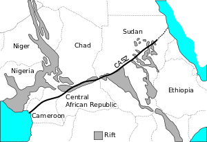
After leaving Egypt, the clan of Jacob (Israel) journeyed by stages, making contact with Hebrew kinsmen at each stage. The first people to help them were their cousins the Midianites (descendants of Abraham by Keturah) in the region of Horeb, the Midianite sacred mountain (Deut. 29:1). 

Another people to help them were the Edomites related to Seir the Horite Hebrew chief named in Genesis 36. The Edomite sacred mountain was Paran (Deut. 33:2). 

Crossing through Edomite territory (where Aaron was buried), the Hebrews moved northeast into Moab. They visited with Lot’s descendants and worshipped on Mount Nebo (Deut. 32:49), where Moses died.

At each of these sacred sites, the reunion of kin was celebrated by a covenant that included animal sacrifice and a night of feasting. These covenants resembled the covenant made between Jacob and Laban at Mizpah (Gen. 31:44-54).

The early Hebrew ruler-priests (4000-2000 BC) established themselves at high places where they built temples, palaces, garrisons, etc. These places were supported by permanent water sources. That is why the earliest known archaeological sites of the Ancient Near East are on high ground near major rivers such as the Tigris, the Euphrates, the Jordan, and the Nile.

Some of the high places served by Hebrew royal priests were dedicated to the sun, the symbol of the High God. (See BIBLICAL ANTHROPOLOGY: Hebrew Ruler-Priests at the Ancient Sun Cities.)


Response to my distinction between the historical realities revealed through kinship analysis and Midrash.

I also have had a positive response to my exposition of the common themes of Midrash, the rabbinic method of interpreting events that took place thousands of years before Judaism emerged. Midrash has influenced the shape of the Jewish ethnic narrative. Some people, including this writer, claim that the influence of the rabbis on Jewish identity has been greater than the influence of the Hebrew Scriptures. 

Knowledge of the social structure of the Hebrew ruler-priest caste explains why many things happened the way they did. However, the midrashim in the Old Testament often give a different explanation for events that took place before Judaism.

Midrash is characterized by some narrative devices such as famines that drive the Hebrew people into other lands. Famines in Caanan are a device to explain why Abraham went to Egypt and why Noami and her family went to Moab. The rabbis are anxious to disguise the fact that there were Hebrew living in Egypt and in Moab. The earliest known Hebrew clans lived in the Nile Valley, and the Moabites and Hebrew share a common ancestor in Terah, Abraham’s father.


However, the Book of Genesis makes it clear that the early Hebrew had dispersed into many regions long before the time of Abraham. Their dispersal was driven by features of their social structure such as endogamy and the sending away of non-ascendant sons.

Another device of Midrash is jealousy among brothers. Though the Genesis story does not explain why Cain killed Abel, midrash supplies the explanation that he was jealous. Likewise, Joseph’s treatment by his brothers is explained as an act motivated by jealousy.

Midrash employs the practice of slavery to explain why Joseph is in Egypt, why Daniel is in Babylon, and why Mordecai and Esther are in Persia. In the sixth century B.C., many Judean noblemen were taken to Babylon, and Babylon was conquered by the Persians who took captives to Susa. These events have been historically verified. Midrash embroiders historical events to convey a theological message.

Midrash tends to point to God or supernatural intervention as an explanation for why things happened. An example is Joseph’s declaration to his brothers: “Now therefore be not grieved, nor angry with yourselves, that ye sold me hither: for God did send me before you to preserve life. For these two years hath the famine been in the land: and yet there are five years, in the which there shall neither be earing nor harvest. And God sent me before you to preserve you a posterity in the earth, and to save your lives by a great deliverance.” (Genesis 45:5-7)

Another example is Mordecai’s declaration to Esther: “Think not with thyself that thou shalt escape in the king's house, more than all the Jews. For if thou altogether holdest thy peace at this time, then shall enlargement and deliverance arise to the Jews from another place; but thou and thy father's house shall be destroyed: and who knoweth whether thou art come to the kingdom for such a time as this?” (Esther 4:12-14)


Jewish Reactions versus Evangelical Reactions

Over the 40 years that I have been investigating the social structure of the biblical Hebrew I have found that Jewish readers are more appreciative of my work than Evangelical Christians who espouse the profoundly errant doctrine of inerrancy.

It is best to read the biblical texts critically, but since God is truthful and He has superintended the Scriptures, they tell us truth. We should read them as if they were law briefs: there is a majority opinion and a minority opinion. Or to express this differently: close listening reveals dominant voices and subservient voices. When these are singing to the glory of God, the music is rapturous.


Monday, July 24, 2017

The Historicity of Noah's Flood


Alice C. Linsley

The historicity of the flood in Genesis is highly probably once we determine when and where Noah lived, using the data of Scripture. One of Noah's grandsons is called "Kush" (Gen. 10) which is also a place name associated with the Nile Valley. This is a clue that Noah lived in Africa, not the Middle East.

Noah lived c. 4200 BC, at a time when the water systems of Central Africa were larger. There was a seaway through the Sahara, and the Benue Trough connected to Lake Chad and to rivers and lakes of the east which in turn connected to the Nile.

Analysis of the kinship pattern of the rulers listed in Genesis chapters 4, 5, 10, 11, 25 and 36 reveals that these rulers have a common ancestry. This is because the Hebrew ruler-priests were a caste and typical of caste, they took the marriage partners from members of the caste (caste endogamy).

The Hebrew ruling lines intermarried. In the diagram below, the intermarriage of the lines of Ham and Shem is evident. Cain's daughter married her cousin and named their firstborn sone Kenan, after her father. Irad's daughter married her cousin and named their firstborn son Jared/Yared/Irad, after her father. Consistent with the cousin bride's naming prerogative, Lamech's daughter, Naamah, named her firstborn son Lamech, after her father.


Genesis 10:8 tells us that Nimrod was a Kushite kingdom builder who established his territory in Mesopotamia. He married a cousin, a Hebrew princess of Sumeria who named their firstborn son Asshur after her father. Abraham is one of Nimrod's descendants. Nimrod was one of Noah's great grandsons. This is a clue that Noah was not Mesopotamian. His homeland was in Africa.


This identical pattern of intermarry (endogamy) is evident between the lines of Cain and Seth. In the diagram below, note that Lamech, a descendant of Cain, had two wives. By his wife Zillah, he had a daughter named Naamah. Naamah married her patrilineal cousin Methuselah. Methuselah is a descendant of Seth. Naamah named her first born son Lamech, after her father. Lamech the Younger is the great grandfather of Noah.


We may logically wonder if Noah might have lived in the Nile Valley (Kush) or perhaps in the region of Lake Chad which connected to the Nile in the period of the African Aqualithic.

The region of Lake Chad was called Borno or Benue, meaning "Land of Noah." Even today the natives of that region consider it to be Noah's homeland. The local Kanuri people call Lake Chad Buhar Nuhu, meaning "Sea of Noah." This is the only place on earth that is claimed by the native population to be Noah's homeland. Since Abraham's early ancestors (4200 BC and before) came out of Africa this should not surprise us.

The Lake Chad Basin is relatively flat and prone to monsoonal flooding. It is ringed by mountains from which water drained into the Basin. The Chad River Basin is shown in this map outlined in red.


At the time Noah lived, the Sahara was much wetter. There was an extensive system of interconnected lakes and rivers. The western Nile watershed extended well into the Sudan. Hydrological studies indicate many periods of flooding from the Nile to the Atlantic coast of Nigeria. Noah lived in the region of Lake Chad. The gray shaded areas show the ancient water ways in the African Sheer Zone.


There was an abundance of reeds. According to Genesis 6:14, Noah's ark was constructed of גפר (gofer/gopher), which is the word used to describe the basket in which Moses floated on the Nile. In other words, the ark was constructed of reeds. The hollow reeds were extremely buoyant. Such vessels are still constructed by the marsh Arabs of Iraq and East Africans.


There is a great deal of evidence that boats were once prevalent in the Sahara. The black mahogany Dufuna dugout (shown below) was found in the Sudan buried 16 feet under clays and sands whose alternating sequence showed evidence of deposition in standing and flowing water. The dugout is 8000 years old. By comparison, Egypt's oldest boat is only about 5000 years old. Peter Breunig (University of Frankfurt, Germany) has written this description of the Dufuna boat: “The bow and stern are both carefully worked to points, giving the boat a notably more elegant form”, compared to “the dugout made of conifer wood from Pesse in the Netherlands, whose blunt ends and thick sides seem crude”. Judging by stylistic sophistication, Breunig reasons that, “It is highly probable that the Dufuna boat does not represent the beginning of a tradition, but had already undergone a long development, and that the origins of water transport in Africa lie even further back in time.”


Boats appear on prehistoric rock paintings in the Sahara. Many show people transporting long horn cows by boat. The Proto-Saharan were cattle-herding. Here are examples of the sickle, incurved sickle, square, incurved square, and flared boat types found on the prehistoric rock art of the Central Eastern Desert of Egypt.


The historicity of Noah’s concern for animals is supported by the discovery that Proto-Saharan rulers kept royal menageries of exotic animals. The oldest known zoological collection was found during the 2009 excavations at the shrine city of Nekhen on the Nile. The royal menagerie dates to about 3500 BC and included hippos, elephants, baboons and wildcats. Noah would have known about the shrine city of Nekhen. It was one of the earliest worship centers for the Horite Hebrew. This painting was found on the wall of a tomb in Nehken.


At Nekhen archaeologists discovered a mummified ruler with red hair and a red beard. Although most of the hair found in the graves at Nekhen was of a dark brown color, natural red hair was discovered in association with the male in Burial no. 79. (Nekhen News, page 8)

Noah and his descendants appear to be in Y-DNA Haplogroup R1b. The R1 rulers were the "mighty men of old" who dispersed into southern Europe, the Tarim Valley of China, and eventually into the British Isles. About 70% of native British men are in Haplogroup R1b. The dark red spot in Central Africa is Noah's homeland near Lake Chad.


Populations of the Lake Chad region before Noah

The oldest known cemetery in the Sahara dates to 7500 B.C., about 3500 years before the time of biblical Noah. The material evidence indicates a settled population at the edge of a very large lake or trough, possibly Lake Mega-Chad which connected to the Benue Trough.

The initial discovery was made by National Geographic photographer Mike Hettwer in 2000, and the excavation work was led by University of Chicago archaeologist, Paul C. Sereno, famous for his discovery of dinosaurs.

About 7500 B.C., at the time that this graveyard was used, Lake Chad had an area of about 249,000 miles. It is likely that the graveyard that Paul Sereno uncovered was originally at the edge of Lake Mega-Chad.

According to a recent report about the cemetery site, "The burial density, tool kit, ceramics, and midden fauna suggest a largely sedentary population with a subsistence economy based on fishing and on hunting of a range of savanna vertebrates."


This Gobero skeleton measures 6 feet.
Photo (c) Mike Hettwer, courtesy Project Exploration


According to Sereno, the Early Holocene people left when it became arid, but the area was repopulated by a taller people around 4600 B.C. when humid conditions returned. That is the time of Noah whose descendants are described as tall in the Bible.

The region was much wetter than today and the inhabitants of the area experienced flooding. There was flooding on and off over a long period, and wet conditions prevailed from 7700-6200 (phase 2).

Sereno states, "The darkened bone color of all human skeletons in phase 2 burials is indicative of sustained inundation." (Read about Sereno's findings here.)

Another wet period corresponds to the time that Noah would have lived in the region of Lake Chad, between 4200 and 3800 B.C.


Wednesday, June 4, 2014

The Stirring of the Waters


Crossing the Red Sea, a wall painting from the 1640s in Yaroslavl, Russia


Alice C. Linsley

The Bible contains many references to water. It is the primal substance at the beginning of creation (Gen. 1). It is used to cleanse, both ritually and literally. The blind man was told to wash in the pool of Siloam and the lepers were to wash before they showed themselves cleansed to the Temple authorities. The great military leader Naaman,when he sought to be cured of leprosy, was told by Elisha to wash 7 times in the river Jordan (II Kings 5:10). The Egyptians made their escape through water, and through the waters of baptism, we who believe receive spiritual regeneration. The Apostle Paul writes that we who are baptized into Christ "have been brought near in the blood of Christ” (Ephesians 2:13).

The most prestigious shrine cities of the ancient world were on major water systems like the Nile and the Tigris or Euphrates. Joseph married the daughter of the priest of On (Heliopolis), a prestigious shrine city on the Nile. His wife's name was Asenath or Asnat. The name sometimes appears in ancient texts as Mari-Anath. Mari means "mother" and is also the Egyptian word for Mary. Mari-Anath may be the same deified mother as Hathor, the mother of Horus. Her name sometimes appears as Hathor-Mari, and many water shrines were dedicated to her. Women came to the shrines to ask the Creator for children. These were places of healing where people went into the water when it was disturbed supernaturally by the wind (Ruach/Spirit).

Even today holy water is used by the Eastern Orthodox as an agent of grace for healing. The priest at Holy Apostles Orthodox Church (Saddle Brook, New Jersey) blessed the Saddle River in January 2014.The ceremony is called the "blessing of the waters" and it is believed that the baptism of "Christ our God" had the effect of making the water holy, and restores the waters of the earth to their original created purpose as an instrument of life.

Here is a description of the ritual: "The blessing was complete with a procession, singing, and Father Matthew trying not to slip in the mud when he blessed the river. The sun shined through the clouds just as we began the service joining our prayers and even the ducks came over to watch. Some say they saw the water stir when it was blessed." (From here.)


Sacred waters

The idea of sacred pools can be traced back to the priests of the Nile Valley who also served as physicians. The Egyptian physician-priest was called wab sxmt (wab sekhmet). Sekhmet Eanach (3000 B.C.) was a physician-priest who "healed the pharaoh's nostrils." (Eanach is a variant of Enoch.) Imhotep (2600 B.C.) was the High Priest of Heliopolis (On) and his skill as a physician became legendary. The Greeks linked Imhotep to Asklepius.

The Greeks and Romans had a similar belief that rose around the cult of Asklepius. The rod of Asklepius is a snake-entwined staff, like that used by Moses for the healing of the snake-bitten Israelites in the wilderness. Asclepius' rod is a symbol of medicine today.

Elisha sent a messenger to say to Naaman the Syrian, "Go, wash yourself seven times in the Jordan, and your flesh will be restored and you will be cleansed." (2 Kings 5:10)

Piye of Nubia set out to conquer the Upper Nile in 730 B.C. He and his troops disembarked at Thebes, the capital of Upper Egypt. There Piye instructed his soldiers to purify themselves before combat by bathing in the Nile and sprinkling their bodies with water from the temple at Karnak. (Kar-nak means "place of rituals.")

Jesus told the blind man to wash in the Pool of Siloam. "So the man went and washed, and came home seeing." (John 9:7b)
Church ruins at Bethesda

In first-century Jerusalem the Pool of Bethesda [Bet-Zeta] was regarded as a place of supernatural healing. The pool was a reservoir for rain water in the 8th century BC, when a dam was built across the short Beth Zeta valley. John 5:2-9 tells this story:

Now there is in Jerusalem by the sheep gate a pool, which is called in Hebrew Bethesda, having five porticoes. In these lay a multitude of those who were sick, blind, lame, and withered, waiting for the moving of the waters; for an angel of the Lord went down at certain seasons into the pool and stirred up the water; whoever then first, after the stirring up of the water, stepped in was made well from whatever disease with which he was afflicted.One who was there had been an invalid for thirty-eight years. When Jesus saw him lying there and learned that he had been in this condition for a long time, he asked him, ‘Do you want to get well?' ‘Sir,' the invalid replied, ‘I have no one to help me into the pool when the water is stirred. While I am trying to get in, someone else goes down ahead of me.' Then Jesus said to him, ‘Get up! Pick up your mat and walk.'  At once the man was cured; he picked up his mat and walked."

Versions based on the Vulgate omit verse 4: "for an angel of the Lord went down at certain seasons into the pool and stirred up the water; whoever then first, after the stirring up of the water, stepped in was made well from whatever disease with which he was afflicted." This is because it is regarded as superstition and presumed not to be originally inspired. On the other hand, it is very likely an authentic picture of the beliefs of people living in Jerusalem during the time of the Second Temple.

Further, the supernatural stirring of sacred waters is a very ancient belief. In Genesis 1 the Spirit hovers over the waters. The image is that of a great bird. The flapping of the bird's wings caused ripples on the surface of the water.

In the beginning God created the heavens and the earth.2 Now the earth was formless and empty, darkness was over the surface of the deep, and the Spirit of God was hovering over the waters.

The Polish anthropologist, Bronislaw Malinowski, discovered a similar belief among the women of the Trobriand Islands in the South Pacific who believed that conception occurred by entering the sacred lagoon when the waters were stirred. 


Sunday, March 23, 2014

Nilo-Saharan and Saharo-Nubian Populations


Alice C. Linsley

In map A (below) we see a densely populated area around Nekhen, the oldest known shrine city of the Horites. The Horites were a caste of ruler-priests who were devotees of Horus, the Seed of the Creator, and his mother Hathor-Meri. Hathor is shown in ancient Nilo-Saharan images with the Y solar cradle on her head, indicating that she was divinely overshadowed.

Excavations at Nekhen (Hierakonpolis) have yielded numerous important artifacts, including evidence of sun veneration, circumcision, a caste of priests and animal sacrifice. The oldest known zoological collection was found during excavations at Nekhen in 2009. The royal menagerie dates to ca. 3500 BC and included hippos, elephants, baboons and wildcats.

pottery shards with dotted and wavy line pattern
After about 7000 BC these people were more widely dispersed throughout the Sahara and near Lake Chad. The epicenter of Noah's flood was likely in the region of Lake Chad. The ruler Noah likely kept a menagerie which he would have protected in the time of flood.

The dispersal of these peoples from the Nile region to Mali, Niger and Southern Algeria is indicated by the wavy-line and dotted pottery (shown right) found at sties across this expanse.


The Holocene Wet Period has be called the "Gurian Wet Period" and the "Aqualithic." The latter term was coined by British archaeologist John Sutton (Journal of Africa History 1974; Antiquity 1977). The Holocene Wet Period owes the abundance of water to climate cycles related to Earth's Great Year, to monsoons off the Indian Ocean, and to the African rifts that created great watersheds or troughs.

Rifting combined with prolonged rains caused this entire region to flood.
Lake Chad is located at the boundary of Niger, Nigeria, Chad and Cameroon. 
Between 12 and 10 thousand years ago, the Nile connected to the Chadic and Niger water systems through a series of shallow lakes in the Sahara Desert. This explains the common plant and animal species found in all three water systems.

"Examination of African barbed bone points recovered from Holocene sites provides a context to interpret three Late Pleistocene occurrences from Katanda and Ishango, Zaire, and White Paintings Shelter, Botswana. In sites dated to ca. 10,000 BP and younger, such artifacts are found widely distributed across the Sahara Desert, the Sahel, the Nile, and the East African Lakes. They are present in both ceramic and aceramic contexts, sometimes associated with domesticates. The almost-universal presence of fish remains indicates a subsistence adaptation which incorporates a riverine/lacustrine component. Typologically these points exhibit sufficient similarity in form and method of manufacture to be subsumed within a single African 'tradition.' They are absent at Fayum, where a distinct Natufian form occurs. Specimens dating to ca. 20,000 BP at Ishango, possibly a similar age at White Paintings Shelter, and up to 90,000 BP at Katanda clearly fall within this same African tradition and thus indicate a very long-term continuity which crosses traditionally conceived sub-Saharan cultural boundaries."(John E. Yellen. 1998. Barbed Bone Points: Tradition and Continuity in Saharan and Sub-Saharan Africa. African Archaeological Review, vol. 15, no. 3, pp. 173-198)

Near Fayum, closer to the Nile Delta, there is evidence of cultural affinity to the Natufians of Palestine.


Related reading: Genesis in Anthropological PerspectiveEgypt in its African Context; Africa is Archaeologically Rich; Boats and Cows of the Nilo-SaharansThe Urheimat of the Canaanite Y; The Nubian context of YHWH; Ancient African Writing Systems of Middle Africa; Water Systems Connected Nile and Central Africa


Thursday, March 6, 2014

Making Sense of Genesis 10


Alice C. Linsley


Genesis 10 is one of the most fascinating chapters of Genesis from an anthropological perspective. It is mistakenly called the “Table of Nations” by Young Earth Creationists who believe that the peoples named here are the first peoples to populate the earth after Noah's worldwide flood.  Rather, we have an account of the dispersion of Nilotic peoples across the ancient Afro-Asiatic Dominion. Among these were the Nilotic Ainu who have been identified through DNA studies as "first nation" peoples.

Genesis 10 provides a picture of how the descendants of Noah were linguistically related people whose point of origin was the Nile valley at a time when the Sahara was wet. All the peoples of Genesis 10 spoke “the same language, with the same vocabulary” (Gen.11:1). These languages are in the Afro-Asiatic group and can be traced back to the Nile Valley. Modern languages developed from the phonemes that were used among these peoples.

DNA studies have confirmed the Kushite migration out of Africa. However, there were already human populations scattered across the earth. Some of those populations resulted from earlier migrations out of Africa. The first took place about 120,000 years ago and the second about 70,000 years ago. The Kushite expansion coincided with the spread of the Horite religion by the Hapiru. In the proto-Saharan languages p is replaced by b so Hapiru also appears as Habiru. Habiru is rendered as "Hebrew" in English Bibles.

Their languages are now largely extinct, but the lexemes can be reconstructed through comparative linguistics. For example, the symbol Y is a solar cradle that represents a whole complex of related ideas including divine appointment, overshadowing, the ruler, the ruler's territory, the ruler's tent, and the ruler's people and herds. This lexeme is reduplicated in the Holy Name YHWH (of Nubian origin).

The linguistic relationship of the clans and castes is evident n the correspondence of their names. So we must look for a third familial phoneme to help us identify units. Consider, for example, this confederation:  Lehab, Lesha  and Letushim (Gen. 25:3). But wait! There may be a fourth: Leummim (Gen. 25:3). Le is a very ancient lexeme. There is also the confederations of Jubal, Jabal and Tubal, and Og, Gog and Magog.

Tsodila Hills of Botswana
Photo credit: S. Coulson
These people comprised a sophisticated network of clans and castes governed by great rulers. They forged the ancient Afro-Asiatic Dominion which extended from Nigeria to India. Noah descendants did spread out of Africa. Genesis 10:8-12 tells us that Noah's great grandson Nimrod built an empire in the Tigris-Euphrates Valley. These rulers were "the mighty men of old" or gibboriym (powerful ones) of Genesis 6:1-4.


Archaic Industry

The evidence of archaic human industry, religion, ritual burial, and domesticity in Africa, Arabia and China creates a more accurate picture of the earlier populations. On the Arabian Peninsula, the Qafzeh population was using tools 125,000 years ago at Jebel Faya.

Humans were making reed mattresses 77,000 years ago in South Africa. That is where the oldest mattress, made from compacted grasses and leafy plants, was discovered at the Sibudu Cave site in KwaZulu-Natal. In this same region a stone carving of a python has been found that dates to 70,000 years.

There is the evidence of mining in South Africa between 80,000 to 100,000 years ago. These are major mining operations that included quarries and tunnels. It is estimated that a million kilos of red ocher ore was excavated from several mines. At one mine half a million stone-digging tools were found. The red ocher was ground to power and was used globally to bury rulers. Anthropologists agree that the red ocher symbolized blood. Apparently, it was connected to the people’s hope or expectation that the ruler might rise from the dead and lead his faithful people to immortality.

The Pengtoushan culture thrived along the Yangtze River between BC. 7500–6100, and the Yangshao culture flourished along the central Yellow River between BC. 5000 and 3000. Yangshao nobles wore silk garments.

About 4000 years before Noah people were using dugouts to navigate the rivers of the Sahara. This is attested by the discovery of an 8000-year old black mahogany dugout in Dufuna in the Upper Yobe Valley along the Komadugu Guna River in Northern Nigeria. At the time when this boat was used the major water systems of Central Africa and the Nile interconnected.


8000 year old dugout found in the Sahara

Cemeteries were established which reveal ritual burial. Paul Sereno unearthed 10,000 year old skeletons at Gobero in Niger. These were buried on the edge of a paleolake on the northwestern rim of the Chad Basin. The Gobero site is the earliest known cemetery in the Sahara and the skeletons found there indicated that some were at least 6 feet tall.


Gobero skeleton (G3B8) measures 6 feet 6 inches
Photo (c) Mike Hettwer, courtesy Project Exploration


At the time of the Gobero populations (9700-4400 years ago), humans were dispersed globally, and during the time of Noah these populations were not destroyed. Consider the following population estimates by urban center between 2400 and 2200 BC, the time when Noah's flood would have occurred:

Memphis, Egypt - 32,000 inhabitants

Lagash, Iraq - 60,000 inhabitants

Mohenjo-daro, Pakistan - 40,000 inhabitants

Mari, Syria -50,000 inhabitants

Baodun settlements, China - Baodun is the largest settlement, covering an area of about 373 miles. There is no evidence of destruction by flooding though all six Baodun settlements straddled the Min River in central Sichuan province. The Min is a tributary of the upper Yangtze River.

There is no evidence that any of these peoples were wiped out by a worldwide flood. The evidence simply does not support the interpretation that all the peoples of the earth were destroyed in a catastrophic global flood and that the earth was repopulated by Noah's descendants.

The Hapiru were a caste of priests who served in the temple. A temple was considered the house or pirû of the deity, so Ha-piru referred to priests who served at the temple or water shrine. In the case of Abraham's people this referred the Horite priests (Horim), devotees of Horus, the "son" or "seed" of the Creator God. His emblem was the sun. The ancient Dravidians referred to their east-oriented temples as Opiru, meaning "Sun House."

Some of these priests were called tera among the Ainu. This is the origin of the name or title of Abraham's father Terah. Among the Ainu of Japan tera refers to a temple. The Ainu people of Japan are in haplotype D (Y-chromosome) and haplogroup X (mitochondrial chromosome). Their elders are bearded and have a red skin tone similar to Abraham's Horite people. Genesis 36 names Seir the Horite as a ruler of Edom = red. The red skin tone Ainu migrated from the Nile to Japan and Eastern Canada, and the dark skin tone Onges and Jarawas (also Haplotype D) migrated to the Maldives, India and parts of Southeast Asia.


Related reading:  From the Nile to The Philippines: Tracing the GurjarsWas the Earth Repopulated After Noah's Flood?; The Nubian Context of YHWY; The Nile-Japan Ainu Connection; The Afro-Asiatic Dominion; Boats and Cows of the Nilo-Saharans; Scientific Verification of the Genesis 10 Dispersion; Noah's Flood: Where and When?

Sunday, August 11, 2013

4,500 Year Harbor at Wadi al-Jarf

Hieroglyphic papyrus found at Wadi al-Jarf (Egypt SCA via AP)

Archaeologists have stumbled upon what is thought to be the most ancient harbor ever found in Egypt, along with the country's oldest collection of papyrus documents, Egyptian authorities say.

The harbor goes back 4,500 years, to the days of the Pharaoh Khufu (Cheops) in the Fourth Dynasty, the Egypt State Information Service reported on Friday. The Great Pyramid of Giza serves as the tomb of Khufu, who died around 2566 B.C.

The harbor was built on the Red Sea shore in the Wadi al-Jarf area, 112 miles (180 kilometers) south of Suez. The find was made by a French-Egyptian mission from the French Institute for Archaeological Studies, according to Friday's dispatch. Discovery News quoted the mission's director, Pierre Tallet of the University of Paris-Sorbonne, as saying that the site "predates by more than 1,000 years any other port structure known in the world."

Read it all here.


Thursday, June 27, 2013

Orientations of Nilo-Saharan Monuments


Alice C. Linsley


The astronomical observations of the ancient Nilo-Saharans led to different orientations for their shrines and burial sites. The majority of the sites show alignment to meridian cardinal directions and the solar arc. This is evident also in the placement of the settlements of first and second royal wives on a north-south axis. Their settlements marked the northern and southern boundaries of their territories. The Creator's solar boat or chariot traverses from east to west. This was viewed at the Creator's daily journey between the eastern and western horizons.

The rulers of Genesis 4, 5, 10 and 11 controlled territories along the ancient water systems. The extreme boundaries of their territories were marked by the settlements of their two wives. As the rivers were oriented more or less on a north-south axis, so were their wives. Abraham's first wife resided in Hebron and his second wife resided to the south in the area of Beersheba.

It has been argued that part of the arrogance of Lamech (Gen. 4) is that his wives Ada and Zillah lived in separate settlements on an east-west axis. In this Lamech set himself as an equal to the One who rules the universe. As the Hebrew scholar Theodor Gaster noted, Adah and Zillah correlate to the Akkadian words for dawn and dust.

These early rulers listed in Genesis provide insight into the thinking of the Nilo-Saharan rulers when it came to the orientation of their monuments. The earliest alignments adhere to either a solar orientation or a north-south orientation. Later sites are found with quarter-cardinal and south-north orientations.


Solar orientation

The temple of Hathor-Meri at Timna was built by the ancient Egyptians. Here the Egyptians oriented the temple to the rising sun at the winter solstice.

Timnah in the Sinai is the site of the world's oldest copper mines. The oldest date to at least 4,000 BC, and there are newer ones as well, totaling about 10,000 shafts. At Timna there are ancient rock carvings showing Kushite/Egyptian warriors in chariots, holding axes and shields. A temple dedicated to Hathor-Meri (later called Isis) was discovered at the southwestern edge of Mt. Timnah by Professor Beno Rothenberg of Hebrew University.

The 19th Dynasty tombs of Merenptah (fourth king) and queen Twosret were constructed so that the light of the rising sun on particular days of the year would pass through the burial chamber and strike the sarcophagus of the king.

Queen Twosret is believed to be the second (cousin?) wife of Seti II. Her name has been found associated with the turquoise mines at Serabit el Khadim and the copper mines at Timna.


North-south orientation

The north-south orientation of shrines and tombs was established by observation of Mekhetyu, the circumpolar constellation identified as the Plough. Meskhetyu is mentioned in the Pyramid Texts as an “imperishable” group of stars. This constellation was associated with Horus, whose totem was the falcon. The falcon-headed Horus supports the platform of Meskhetyu.

In 2005 Tomb 23 was discovered at Nekhen in Sudan. This was the largest structure of its kind from the Naqada II period (c.3500 - 3200 BC) and it was oriented north–south.


South-north orientation
King Horemheb

King Horemheb, the last king of the 18th Dynasty, built two tombs. His tomb (designated KV57) is in the Valley of the Kings and his old tomb is at Saqqara. 

The axis in degrees of tomb KV57 is 357.72 and the orientation of the axis is north. This represents a later development which subsequently became the norm for most of the royal tombs in the Valley of the Kings.

Horemheb was from Nekhen, the oldest known shrine city dedicated to Horus, the patron of kings. Nekhen is south of his Theben necropolis and likely Horemheb's choice of orientation was simply to face north from his home.

Horemheb's old tomb at Saqqara was used for the burial of his queen Mutnodjmet. It was built between 1333 and 1323 BC. Mutnodjmet was Nefertiti's sister.


Quarter-cardinal orientation

Another orientation resulted from rotating the N-S line by 45°, 90° or 135°. This quarter-cardinal orientation is especially evident at Upper Nile/Nubian shrines. This rotation meant that the definitive axis was aligned either perpendicular to the Nile or parallel to the Nile.

At most of the temples at Thebes the axes of the monuments were rotated by 135° from the astronomical north-south line. This mean that the temple facades were almost perpendicular to the Nile.  Many sacred shrines of the ancient world faced great rivers.


Abydos' three areas

During the Middle Kingdom (c. 2000 BC) excavations were made by the Egyptians at Abydos, located south of Cairo. Apparently, they were searching for the tomb of Osirius, who was believed to be one of the first kings of Egypt. The tomb of Djer was identified at that time as the burial place of Osiris in Abydos. Because it was believed that Osiris was buried at here, Abydos became an important cult center during Abraham's lifetime (c. 2000 BC). The modern name for the site is Umm el-Qaab, which means “Mother of Pots” in Arabic. This name is due to the great number of Late Period sherds scattered in the piles of debris.

By 3400 BC Abydos had developed into an elite cemetery, and between 3050 and 2700 BC, it became the burial site of the kings of Egypt. Since 1977, the area has been excavated thoroughly by the German Archaeological Institute.

Abydos comprises three areas. Cemetery U which is situated on a plateau, dates to the early Naqada Period (c. 4400-3700 BC). It contains 650 graves. Abydos was an important shrine city at the intersection of the Nile, and a traffic route from the Red Sea through Wadi Qena to the oases in the Western Desert. Cemetery U was in use throughout most of the Naqada Period (4400-3000 BC).

Cemetery B contains the graves of the last Predynastic rulers Irj-Hor, Ka, and Narmer, and the tomb complex of Hor-Aha, founder of the 1st Dynasty. Hor-Aha's three chambers had a southwest intercardinal orientation of 225°

Seven large tomb complexes have also been identified. One of these is identified with king Djer, son of Hor-Aha. Hor-Aha's first wife was Benerib and his second wife was Khenthap. Khenthap is named as king Djer's mother on the Cairo Annals Stone. Again we find the early practice of rulers having two wives, as was the custom among Abraham's Horim.

Bracelet found in the tomb of Djer


Related reading: The Orientation of Ancient Egyptian Temples; The Orientation of Ancient Tombs in Egypt; Was the Giza Sphinx a Recumbent Lion?The Religion of Tamar at Timna; Genesis on the Ancient Kingdom Builders; The Marriage and Ascendancy Pattern of Abraham's People


Thursday, September 27, 2012

Evidence of Ancient Streams on Mars


Nasa's Curiosity rover has only been on the surface of Mars seven weeks but it has already turned up evidence of past flowing water on the planet.

The robot has returned pictures of classic conglomerates - rocks that are made up of gravels and sand.

Scientists on the mission team say the size and rounded shape of the pebbles in the rock indicate they had been transported and eroded in water.

Researchers think the rover has found a network of ancient streams.

Read it all here.


Thursday, November 10, 2011

The Genesis "Begats" Speak of Archaic Rulers, Jesus Christ

Alice C. Linsley


The “begats” of Genesis list ruler-priests of a vast territory that extended from Nigeria to India between10,000-3000 years ago when this part of the world was wet. The point of origin of these rulers and their people is biblical Eden, a well-watered region that extended from the Nile Valley to the Tigris-Euphrates Valley.
Waterways seen from space (NASA photo)

In Noah’s time (about 2,500 BC) this region was much wetter. Lake Mega-Chad had an area of 249,000 miles and connected several lakes and rivers. Lake Mega Chad was about 600 feet deep.

The water systems controlled by the rulers included the Nile, the Red Sea, the Jordan River and the part of the Sahara that was wet in the late Holocene. Southern Arabia was also much wetter. The region is called Ha-dhra-maut, derived from dhara which in the Dravidian referred to channels of water and maut which in Egyptian meant mother.

This 8000 year old dugout (shown right) was discovered 16 feet below the Saharan clays and sands in the Upper Yobe valley along the Komadugu Guna River in Northern Nigeria. (The oldest Egyptian boats are only about 4000 years.)

The rulers of this region expanded their territories and established new territories. One such ruler was Nimrod, known as Sargon the Great. He moved into the Tigris-Euphrates Valley and built great cities there. An earlier city builder was Kain (Cain) who lived at the western edge of Eden.
The great water systems were interconnected then, making movement between the land masses easier. The movement of Abraham’s Kushite people out of Africa has been confirmed by DNA studies, linguistics, archaeology and biblical anthropology.

The symbol of the ruler and his territory was the tent peg, represented by the vav in modern Hebrew (waw in ancient Hebrew and in Arabic).

The waw/vav orignally symbolized the crook/hook of the ruler or the tent peg of the ruler's tent. As a glyph this represented a cluster of related ideas including:
  • the ruler himself
  • the ruler's authority
  • the ruler's territory
  • the ruler's clan or tribe
  • the ruler's resources such as his flocks and water sources

The waw/vav speaks of an ancient world in which settlements near water were ruled by elders and a chief. Travelers moved from settlement to settlement and the ancient water laws were generally generous to those who wa-ndered. Wells were neutral ground for waring parties or enemies, but were fought over, as in the story of Moses driving away the intruder shepherds at the well of the Midianite ruler-priest Reu-el. (Exodus 2:16-19). It was common for the river, lake, oasis or well to have a shrine over which their was a priest. So it is not surprising to read that Moses' future father-in-law was a "priest of Midian." As such, he was a direct descendant of Abraham by Abraham's cousin bride, Keturah.

Many words in various languages today still reflect this ancient world. Consider these examples: wa-ter, wa-gon, va-gabond, va-grant, va-gar meaning "to wander" (Spanish), wa-kdar meaning "ruler" (Pashto), and ya-raki meaning "power" (Persian).

Those who needed water went from Y to Y, which is to say "from water settlement to water settlement."

The great chiefs of the biblical world were designated as such by the initial Y in their names. This is more evident in Hebrew than in English. Consider the following:

Yishmael - Ishmael (Abraham's son by Hagar)
Yitzak - Issac (Abraham's son by Sarah)
Yaqtan - Joktan (Abraham's firstborn son by Keturah)
Yishbak - Yishbak (another of Abraham's sons by Keturah)
Yacob - Jacob
Yeshua - Joshua/Jesus

Consider the importance of wells in the lives of these biblical figures. Ishmael's life was saved when an angel revealed a well or spring to his mother. Abraham's servant found Isaac a wife at a well. Moses met Zipporah at a well. Jesus met the Samaritan woman (Photini) at Jacob's Well.


Related reading: Egyptian Shrines on the Horus Way; Water Systems Connected the Nile and Central Africa; The Jordan River; Wells and Brides; The Migration of Abraham's Kushite Ancestors; A Woman at a Well; Susan Burns on Hadhramaut of Arabia

Tuesday, February 22, 2011

Egyptian Shrines on the Horus Way


Alice C. Linsley


The Horus Way was the southern section of the Way of the Sea (derek hayyam) mentioned in Isaiah 9:1. It was a military road that ran through Tharu (Tjaru/Sile) in the Sinai and Rafah in Gaza, joining the Nile Valley to the Levant. There were numerous Egyptian fortifications along the Horus Way. The Egyptians exercised control over much of the land of Canaan for a long time.

Exodus 14:2 says the Israelites crossed near Migdol. Migdol is an archaic word for a fortification. This is likely the Migdol of Men-maat-re (Seti I), the third named fort along the ancient Horus Way. The Horite Hebrew would have known of this route. The place of crossing is a shallow marshy lake which recedes when the wind blows at 40-50 mph for more than 5 hours. As with all the miraculous signs described in Exodus, the miracle is in the timing.

The Egyptians had fortified settlements at many locations. During the Middle Bronze Age (ca. 2200–1500 BC) as much as 70% of the populations of Canaan lived in these fortified towns. Tell el-‘Ajjul is one example. Another is the fortified city of Gezer with its gate, tower, and protected water system. These would have been built under the direction of the ruler of the area, probably a vassal of the Pharaoh. The Judean high places were under the control of Egypt from about 2000 to 1178 BC. The tenth century BC Gezer Calendar appears to reflect Nilotic farming practices. The Gezer Calendar is a small limestone tablet listing seasonal agricultural activities in seven lines of uneven letters. Christopher Rollston contends “there is no lexeme or linguistic feature in the Gezer Calendar that can be considered distinctively Hebrew” and Joseph Naveh says that “No specifically Hebrew characters can be distinguished.” (From here.)

The Egyptians built shrines and temples wherever they went. The first New Kingdom temple ever found in northern Sinai has been located at Tharu. There was a shrine dedicated to Horus with the image of a lion.

On Seti I's relief at the Karnak complex, a map of the Horus Way shows 11 forts and a north-south reed lined waterway called “ta denit” (the dividing waters). Likely, there were Horus shrines at all of these forts, and these would have been attended by Horus priests called Horites. The Horites were a moiety of the Hebrew priest caste, sometimes called Habiru, Hapiru, Abrutu, Abhira, ‘Apiru, and Abiru (from the ancient Akkadian Abru, meaning "priest".) Genesis 4-11 chronicles the dispersion of the Hebrew ruler-priest caste out of Africa in the service of kingdom builders and high kings. This Wikipedia article is about the Abiru caste of "royal ritualists" found in Rwanda.


A part of Seti I's relief shows him herding captives before his chariot. He approaches a north-south canal or waterway with reeds and crocodiles and Egyptian buildings. Some believe that Tharu was on the east side of this waterway. Max Muller said that "no town of the eastern delta frontier has a greater importance than Tharu [i.e. Tjaru], which was not only its largest town, but also the principal point for the defense of the entrance to Egypt, therefore also for the military and mercantile roads to the East." (James K. Hoffmeier, Israel in Egypt: The Evidence for the Authenticity of the Exodus Tradition, 1997: 184.)

The Egyptians also built Horus temples in their administrative centers such as Beit She’an on the Jordan.  A large Canaanite temple excavated by the University of Pennsylvania Museum may date from about the period as Thutmose III’s conquest, but excavations done by The Hebrew University indicate that this temple was built upon an older one. The excavation included three monumental basalt stelae with inscriptions from the reign of Seti I and Ramsess II, a life-size statue of Ramsess III, and numerous other Egyptian stelae and inscriptions, which constitute the most significant assemblage of Egyptian monuments ever  found in Israel. Of special interest is the discovery near the temple of a basalt relief depicting two combat scenes between a lion and a dog.

Beit She'an was called Scythopolis by the Greeks. Beit She'an was also called Beth-abarah (House of the Ford) because it was opposite the ford in the Jordan. The Arabic word for ford is abarah. Sir George Grove in Dictionary of the Bible identifies Bethabarah as Beth Nimrah, a few miles above Jericho. Jesus was probably baptized here by John.

If this is the water shrine where Jesus was baptized, we have another connection to the Horite expectation of the Son/Seed of God. Could it be that He is the Lion of the shrine in Tharu on the Horus Way and the Lion on the stela found near the most ancient temple in Beit She'an? Horus, called the son of Ra, was often shown as a man with the head of a lion or a falcon. Sometimes he is shown as a solar disk between two guardian lions, one looking east and the other looking west.


Among the Nubians the sun was a central symbol of life and was often shown as a red orb. This lent the additional association with the red eye of Horus. In this ancient Nubian relief we see baboons facing the sun. Baboons chatter at the rising sun. In other versions two lions or two leopards face away from the sun. They are sentinels or guards. The ankh or cross symbol is found over the heads of the baboons.


Between the baboons is the dung beetle or scarab. Among Abraham's Horite caste the heart was the single organ that was not extracted from the mummified body. All the other organs were removed and stored in canopic jars. The heart was the essential organ when it came to resurrection of the body, as it would be weighed in the afterlife. The body of the pure-heart would rise from the dead, as the sun rises in the morning. This is the significance of the dung beetle scarab placed over the mummy's heart.

Some claim that this image represents Duat which they interpret as the cycle of reincarnation or the transmigration of souls. However, the Duat of ancient Egypt is not the same as Samsara. It is about the mirror image of the cosmos patterned on the Sun's rising and setting. The long expected ruler rises from death with the sun on the third day.

Oh Horus, this hour of the morning, of this third day is come, when thou surely passeth on to heaven, together with the stars, the imperishable stars. (Pyramid Texts Utterance 667.1941b)

The body of the dead ruler was carried in procession to the tomb or pyramid, his retinue following behind. The procession to the tomb was the earthly journey that would be continued beyond the grave at the deified ruler's resurrection. This stands behind Paul’s description of Jesus Christ leading captives from the grave to the throne of heaven. This is why it says: When he ascended on high, he led captives in his train and gave gifts to men. (Eph. 4:8)

In the image above, the eyes of Horus are seen to the right and left of the rising sun. This establishes the theological context as Horite. Abraham's ancestors were devotees of Horus, the seed or son of Ra. He was born of Hathor, who conceived by the overshadowing of the sun. Her totem was a cow and she is shown at Nile shrines holding her infant in a manger. Here we have elements of the Proto-Gospel and evidence that Messianic expectation is based on the Edenic Promise (Gen. 3:15) made to Abraham's Proto-Saharan and Nilotic ancestors.

One of the shrines on the Horus Way was at Timnah. The copper mines here are at least 6,000 years old and there are newer ones as well, totaling about 10,000 shafts. The oldest mines were worked almost continuously until the Roman Period. There are ancient rock carvings showing Kushite warriors in chariots, holding axes and shields. A temple dedicated to Hathor, the mother of Horus, was discovered at the southwestern edge of Mt. Timnah by Professor Beno Rothenberg of Hebrew University.


Related reading:  Of Dung Beetles and Red Herrings; Solar Imagery of the Proto-Gospel; Abraham's ComplaintThe Ra-Horus-Hathor Narrative; Science and Miracles


Sunday, February 13, 2011

The Jordan River

Nehar haYarden (Hebrew)
Nahr al-Urdun (Arabic)
 Alice C. Linsley


The Jordan's source is near the northern most point of Palestine and issues from the cave of Paneas, about one hour's distance south of the town of Banias. The Hebrew and Arabic names are Yarden and Urdun, meaning "descender" because the river flows down from a higher altitude.

The Jordan River is mentioned only three times in Genesis. The first is Genesis 13:10 where the Jordan Plain is described as well watered, "Like the garden of the Lord or the land of Egypt." Today the Jordan cuts so deep into the earth that it is difficult to imagine much of a plain. Most places along the Jordan are not suitable for cultivation. This suggests that Abraham and Lot dwelt where the land had a gentler slope down to the river. This would be closer to Jericho, probably the longest continually inhabited city in the world.

The second mention of the Jordan is in Genesis 32:11.  Here Jacob speaks of crossing the Jordan to go to his mother's people in Padan Aram. Genesis doesn't tell us how Jacob crossed the river, but he likely paid a boatman to take him across at the place where the Jordan meets the Jabbock River, an eastern tributary. He would have continued by boat as far east as the ancient Jabbock allowed.  In Jacob's time the region was wetter and more of the water systems connected.

The Jordan River is mentioned again in Genesis 50:10 which speaks of Joseph and the Egyptians mourning for Jacob who was buried, not at Machpelah, but somewhere on the east side of Jordan. He was probably buried among the Horites living around Jabal Harun in Jordan.


The Jordan in Abraham's Time

Abraham and Lot are said to have gone separate ways, with Lot electing to live in the watered plain near Sodom and Abraham keeping to the higher ground along the ridges between Hebron and Beersheba. Genesis therefore tells us nothing of Abraham's experience of the Jordan. However, in Abraham's time the water level would have been higher due to greater run off in a less arid climate.  For example, 1 Kings 17:3 mentions a eastern tributary that flowed into the Jordan which no longer exists. It was called the Cherith.

We don't know what the Jordan was called in Abraham's time.  His people may have used the Egyptian word for river ar (similar to the Arabic nahr). In ancient times rivers and lakes were often called "seas" either because the people had no conception of a real sea or because many of the major water systems were connected. The peasants of ancient Egypt spoke of the Nile as a sea. The Sea of Galilee, which is a lake, is another example.

The Jordan River is ony 156 miles long (251 kilometers). It becomes wider and deeper as it flows southward to the Dead Sea (1,300 feet below sea level). Modern Jericho is only about six miles north of the Dead Sea and five miles west of the Jordan, but the earliest neolithic peoples settled there because it was a natural oasis, with a powerful natural spring and was near the Dead Sea. This earliest settlement at Tell es-Sultan was excavated by Kathleen Kenyon between 1952-58. She gave it the name of Ariha al-Ula, the first Jericho. In biblical times, this part of the Jordan was referred to as the "Jordan of Jericho" and there would have been a sizeable fertile plain in Abraham's time. It had palm trees and fields under cultivation most of the year.  It would indeed have been like Egypt.

Today the dry climate, diversion of tributaries, and massive salt evaporation projects in the southern part of the Dead Sea have caused dramatic drops in the sea’s level. However, photos taken from space (such as image on left) show that the ancient shorelines of the Jordan and the Dead Sea expanded beyond where they are today.